31 places
Camping in Vietnam
Sleep under the stars in Vietnam's most remote places
31 locations for camping
🏔️ Mountain
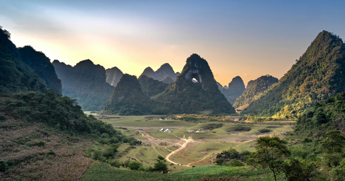
Angel Eye Mountain (God Eye Mountain)
📍 cao bang
Angel Eye Mountain - also known as God Eye Mountain or Núi Thủng - is a limestone karst peak in Cao Bằng with a perfectly circular 50m hole piercing through its summit, set in the Thang Hen valley where the surrounding flatland floods into a 15-hectare lake each rainy season.

📍 Lake
Ba Be Lake
📍 bac kan
Ba Be Lake is Vietnam's largest natural freshwater lake - a 8km-long body of water set within a national park of karst limestone mountains, primary forest, and Tày ethnic minority villages in Bắc Kạn province, one of the most genuinely wild nature destinations in the northern highlands.
🏝️ Island
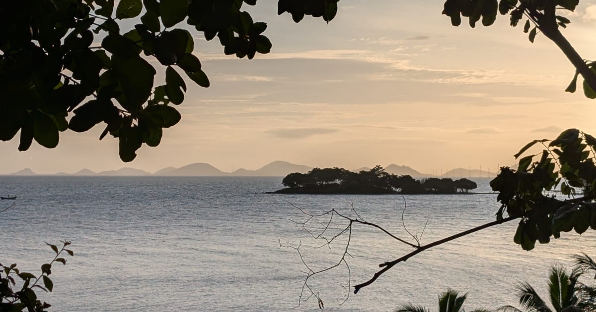
Ba Hòn Đầm Islands
📍 kien giang
Ba Hòn Đầm is a cluster of three small islands in the Bà Lụa Archipelago, Kiên Lương - undeveloped, rarely visited by foreigners, and reached by a 30-minute boat from Kiên Lương pier, with clear water, rocky coves, and basic overnight options on the island.

🌿 Forest
Bidoup Núi Bà National Park
📍 lam dong
Bidoup Núi Bà National Park protects the largest remaining tract of highland cloud forest in southern Vietnam - a 70,000-hectare wilderness of montane jungle, endemic birds, and multi-day trekking routes 50km north of Đà Lạt.

🌿 Forest
Bù Gia Mập National Park
📍 binh phuoc
Bù Gia Mập National Park is one of the last intact lowland rainforest blocks in southeastern Vietnam - a 26,000-hectare wilderness on the Cambodian border in Bình Phước with gibbons, gaur, and multi-day trekking routes through primary jungle.

🏔️ Mountain
Bùi Hui Grassland
📍 quang ngai
Bùi Hui Grassland is a highland meadow at 700m elevation in Ba Tơ district, Quảng Ngãi - a wide-open landscape of rolling hills, sim berry shrubs, and cool mountain air, home to the H're ethnic minority and one of Quảng Ngãi's most scenic camping destinations.

🌿 Forest
Cát Bà National Park
📍 hai phong
Cát Bà National Park covers 17,000 hectares of the island's rugged interior - the last habitat of the critically endangered golden-headed langur, with jungle trails to a 331-metre summit viewpoint over Ha Long Bay and Lan Hà Bay simultaneously.
🌿 Forest
Cát Tiên National Park
📍 dong nai
Cát Tiên National Park is the most accessible serious wildlife destination from Ho Chi Minh City - a UNESCO Biosphere Reserve of 72,000 hectares protecting lowland rainforest, over 350 bird species, and the Dao Tien Endangered Primate Species Centre.

🏔️ Mountain
Núi Chứa Chan (Chứa Chan Mountain)
📍 dong nai
Chứa Chan is located in Xuân Lộc District, about 90 km east of Ho Chi Minh City. The mountain sits just off National Highway 1A and is easy to reach by motorbike or car, with the journey taking around two hours from the city. Most visitors start at the parking area at the base of the mountain, where two routes begin: a long concrete staircase leading to Bửu Quang Pagoda, and a quieter forest trail used by hikers heading to the summit.

📍 Lake
Dầu Tiếng Lake
📍 tay ninh
Dầu Tiếng Lake is the largest artificial reservoir in Vietnam - a 270km² expanse of water on the Tây Ninh and Bình Dương border, surrounded by forest and used for irrigation, with sunrise photography and lakeside cycling as the main visitor draws.
🏔️ Mountain
Núi Dinh (Dinh Mountain)
📍 ba ria vung tau
Núi Dinh is a 504m coastal peak in Bà Rịa–Vũng Tàu province - the highest point in the region, with forested trails, a summit pagoda, and panoramic views over the Vũng Tàu peninsula and the South China Sea.

🏖️ Beach
Đồi Nhái Beach
📍 ba ria vung tau
Đồi Nhái Beach is a 3.8km undeveloped stretch of coastline near Phước Tỉnh in Bà Rịa-Vũng Tàu - no facilities, no crowds, and one of the better sunrise spots on the southern coast within 100km of Ho Chi Minh City.
🏝️ Island
Pirate Islands
📍 kien giang
The Hai Tac Islands are a remote archipelago of 16 islands in the Gulf of Thailand off the Kien Giang coast, historically known as the Pirate Islands. One of the least visited island groups in Vietnam, with coral reefs, white sand beaches, and almost no tourist infrastructure.
🌿 Nature
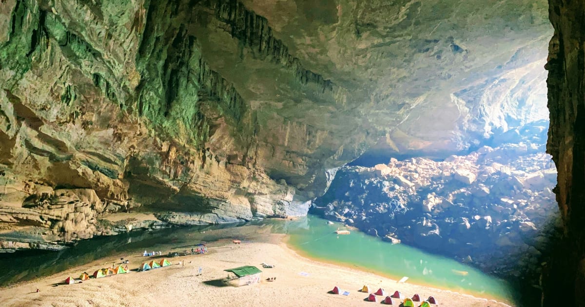
Hang En Cave
📍 quang binh
Hang En is the third largest natural cave in the world, hidden deep inside Phong Nha-Kẻ Bàng National Park in Quảng Bình. Reaching it requires an 11km trek through jungle, river crossings, and the remote Bru-Vân Kiều village of Bản Đoòng - with a night camping on a white sandbar inside the cave itself, under a ceiling 145 metres high filled with thousands of nesting swallows.

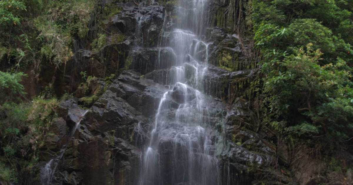
💧 Waterfall
K50 Waterfall
📍 gia lai
K50 Waterfall in Kbang district, Gia Lai is one of the Central Highlands' most spectacular hidden falls - a 50-metre cascade in primary jungle that requires a full-day trek through Kon Ka Kinh National Park to reach, rewarding those who make the effort with one of the most remote natural scenes in the region.

📍 River
La Ngâu Stream
📍 binh thuan
La Ngâu Stream in Tánh Linh district, Bình Thuận is a jungle river cutting through the interior lowlands of Vietnam's south-central coast - a sequence of natural pools, small rapids, and overhanging forest that offers one of the most accessible wild swimming and camping experiences in the region.

🏔️ Mountain
Langbiang Mountain
📍 lam dong
Langbiang Mountain is the highest peak in the Đà Lạt plateau at 2,167 metres - a twin-peaked massif rising above pine forest north of the city, home to the K'Ho ethnic minority, with a summit trek rewarded by panoramic views over the entire Central Highlands.

🏔️ Mountain
Masara Hill
📍 lam dong
Masara Hill in Đức Trọng district, Lâm Đồng is a 30-hectare expanse of open grassland that turns pink from mid-November to mid-December - one of the few places in Vietnam where this seasonal transformation happens at scale, and largely unknown to foreign visitors.
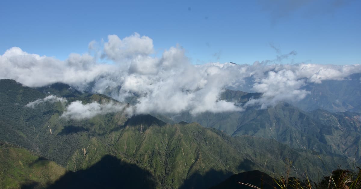
🏔️ Mountain
Mẫu Sơn Mountain
📍 lang son
Mẫu Sơn is one of the few places in Vietnam where snow falls - a 1,541m massif in Lạng Sơn province near the Chinese border that experiences genuine subalpine conditions in winter, with frost, occasional snowfall, and a sea of clouds that makes it one of the most dramatic landscapes in the northeast.
🌿 Nature
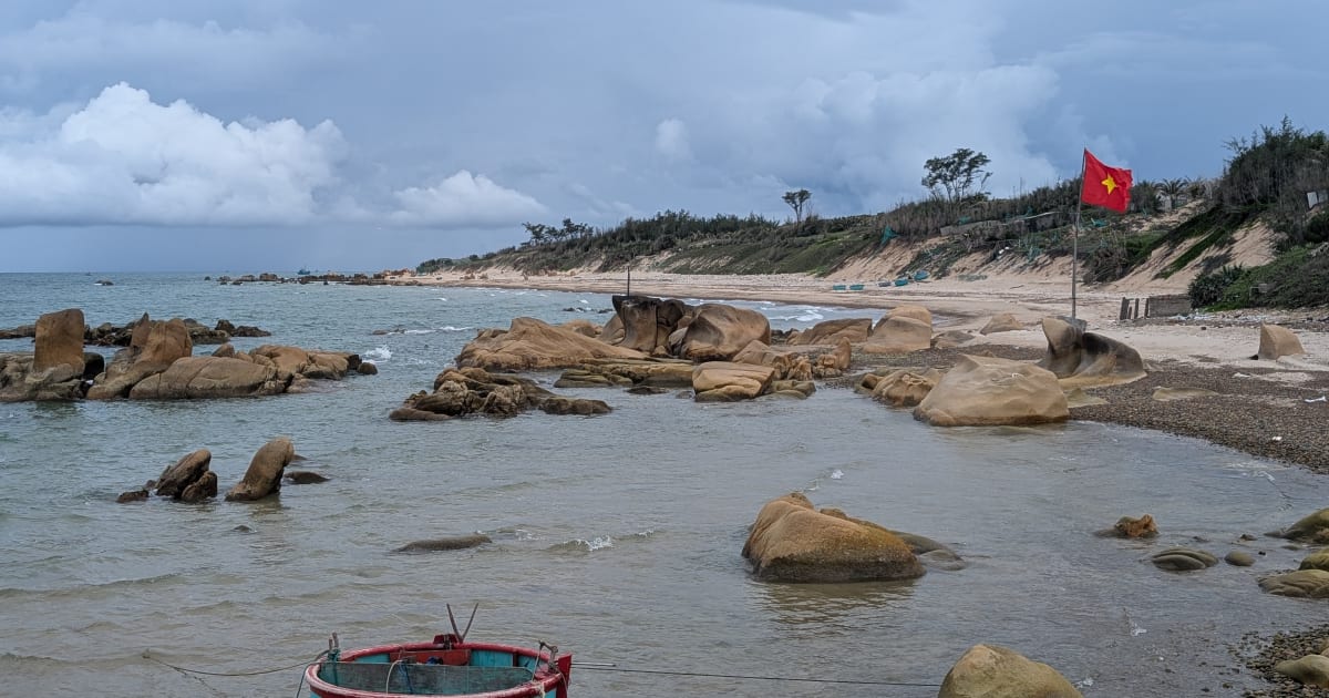
Mũi Trọ Fishing Village
📍 binh thuan
Mũi Trô is a tiny, nameless-on-most-maps fishing village on the Bình Thuận coast - a handful of houses, round basket boats, and a rocky pebble beach that almost no foreign traveler has visited, sitting 2km off the road near Cô Thạch beach.

🏝️ Island
Nam Du Islands
📍 kien giang
Nam Du is Vietnam's southernmost island archipelago - a group of 21 islands in the Gulf of Thailand, Kiên Giang, with some of the clearest water in southern Vietnam, untouched outer islands, and a fishing community that has operated without resort infrastructure.

💧 Waterfall
Phi Liêng Waterfall
📍 lam dong
Phi Liêng Waterfall is a remote multi-tier waterfall in Đam Rông district of Lâm Đồng - deep in the forest north of Đà Lạt, far from the tourist circuit, with a wide base pool suitable for swimming and an approach through highland forest and K'Ho community villages.

🌿 Nature
Son Doong Cave
📍 quang binh
Son Doong is the largest cave in the world - big enough to contain a 40-story skyscraper, with its own weather system, jungle, and river inside. Access is by 4-day expedition only, with a strict annual quota of 1,000 visitors, making it one of the most exclusive natural experiences on earth.
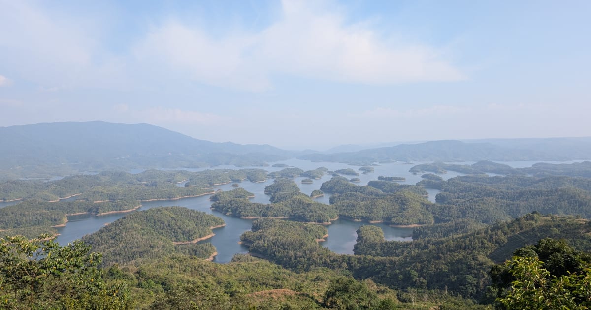
📍 Lake
Tà Đùng Lake
📍 dak nong
Tà Đùng Lake in Đắk Nông province is called the 'Hạ Long Bay of the Central Highlands' - a vast reservoir studded with 37 forested islands rising from the water, formed by the flooding of Tà Đùng National Park, offering kayaking, island camping, and some of the most unusual inland scenery in southern Vietnam.
🏔️ Mountain
Ta Năng - Phan Dũng Trek
📍 lam dong, binh thuan
The Ta Năng - Phan Dũng Trek is Vietnam's most celebrated multi-day wilderness route - a 3-day crossing from the Lâm Đồng highlands to the Bình Thuận coast through remote forest, river valleys, and grassland used by nomadic cattle herders.
🏔️ Mountain
Tà Xùa Mountain
📍 yen bai
Tà Xùa in Trạm Tấu, Yên Bái is a jungle trek through one of northern Vietnam's most atmospheric moss forests - ancient trees draped in green moss and lichen, a trail that climbs through primary forest to a series of dramatic rocky outcrops with panoramic views over the Mông valley below.
📍 Lake
Thang Hen Lake
📍 cao bang
Thang Hen is one of Vietnam's most extraordinary lakes - a cluster of 36 interconnected lakes on a karst plateau at 900 metres elevation in Cao Bằng, their water an intense turquoise-blue from dissolved limestone minerals, surrounded by forested cliffs and almost entirely unknown to international travellers.
📍 Lake
Tri An Lake
📍 dong nai
Tri An Lake is a large reservoir in Dong Nai province, 60km from Ho Chi Minh City, formed by the Tri An hydroelectric dam on the Dong Nai River. A popular weekend camping and kayaking destination for city residents, with forested islands, calm water, and dramatic sunset views.

🌿 Nature
White Sand Dunes
📍 binh thuan
The White Sand Dunes of Mũi Né are Vietnam's most surreal landscape - vast white dunes stretching to the horizon beside two freshwater lakes, nicknamed the 'Sahara of Vietnam', best experienced at sunrise when the light turns the sand pale gold and the lakes reflect the sky.
💧 Waterfall
Yavly Waterfall
📍 binh thuan
Yavly Waterfall is a remote cascade deep in the forest along the Tà Năng - Phan Dũng trekking route, one of the most celebrated multi-day wilderness treks in southern Vietnam. Reached only on foot after a full day of hiking through grasslands and primary forest, it is the kind of waterfall that has to be earned.
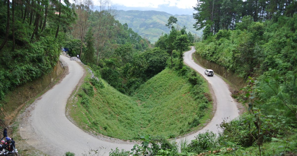
🌿 Forest
Yên Minh Pine Forest
📍 ha giang
The Yên Minh Pine Forest is an unexpected stretch of highland pine on the Ha Giang Loop between Quản Bạ and Đồng Văn - a 10km section of road through dense Pinus kesiya forest at 1,200 metres, with morning mist threading between the trees and a completely different atmosphere from the surrounding karst landscape.
Browse other experiences
Beaches41 placesTrekking76 placesCaving11 placesSnorkeling18 placesKayaking20 placesFood21 placesCulture105 placesHistory69 placesPhotography214 placesMarkets4 placesNightlife7 placesWalking Tours83 placesCycling33 placesBoat Tours40 placesCable Cars6 placesHomestays10 placesWildlife37 placesMotorcycling30 placesShopping2 places