Menu
ProvincesLocationsExperiencesBlogMap
📍 mountain · ly son

Núi Thới Lới

Núi Thới Lới is Lý Sơn's highest point at 169 meters - an extinct volcanic crater where a 20-meter national flag tower stands facing the Hoàng Sa (Paracel) Islands. The summit offers the best panoramic view on the island: garlic fields, fishing villages, Đảo Bé, Hang Câu beach, and open sea in every direction.

🌋 Extinct Volcano🏔️ Highest Point on Lý Sơn (169m)🚩 National Flag Tower🌅 Sunrise Viewpoint
🧭 Get Directions
Best Time to Visit
📅 Mar - Aug; arrive before sunrise for the best panoramic light over the island
Entry Fee
🎟️ Free
Opening Hours
🕐 Open 24/7
Address
📌 An Hải, Lý Sơn, Quảng Ngãi
👥Crowds
Few tourists visit early morning; mostly local youth present. Can be crowded during sunset hours.
🥾Difficulty
Road is steep with sharp descents requiring good braking. Manual transmission motorcycles recommended over automatic scooters. Walking sections are moderate.
⚠️Safety
Avoid visiting at sunset or when few people present due to reported harassment incidents. Strong winds can be dangerous near cliff edges. No railings or barriers. No toilet facilities available.
🚶Accessibility
Motorcycles can reach the summit. Narrow road makes car passage difficult and challenging for oncoming traffic. Some hiking trails overgrown or blocked by vegetation.
🌤️Seasonal
Summer (8am-4pm) extremely hot and sunny; early morning visits (from 5am) recommended with cooler weather and sunrise views. Afternoon light (around 3pm) best for photography.

What Makes Núi Thới Lới Special

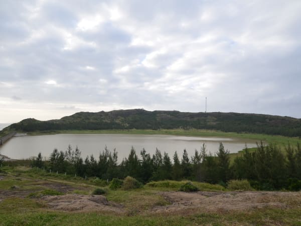
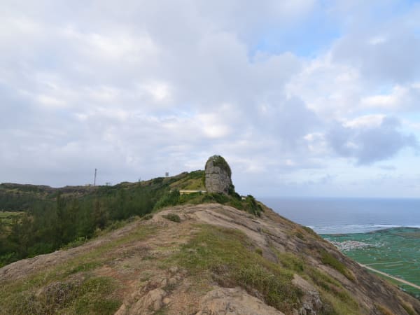
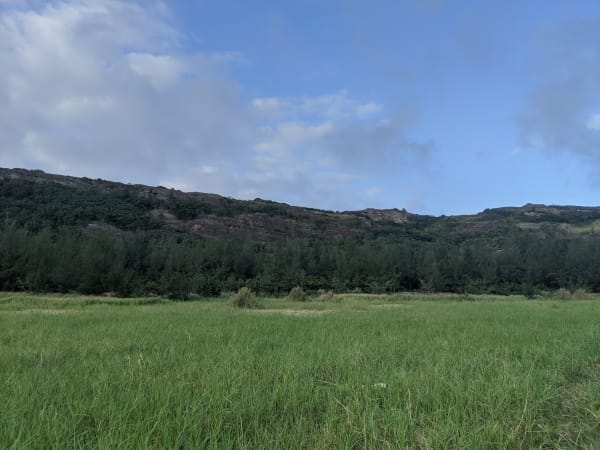
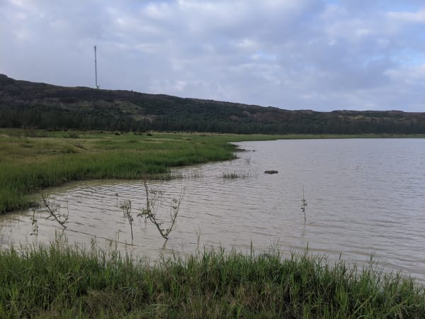
Núi Thới Lới is the highest point on Lý Sơn at 169 meters - an extinct volcanic crater that last erupted millions of years ago and now forms the island's dominant landmass. The summit is capped with a 20-meter national flag tower, built in 2013 and oriented to face the Hoàng Sa (Paracel) Islands to the northeast - a deliberate statement of sovereignty in an area of ongoing territorial dispute. From the rim of the crater, the entire island is visible: garlic and onion fields spreading across the flat sections below, the cluster of fishing villages along the shore, Đảo Bé floating on the water to the west, and Hang Câu beach directly at the mountain's base. On clear mornings the view extends across open sea in every direction.

🚗 Getting There

From the ferry port in An Vĩnh, head east along the coastal road toward An Hải. The road to Núi Thới Lới branches inland - it is signposted and most guesthouses can give directions. The drive takes around 15 minutes by motorbike. The road up the mountain itself is steep and narrow - experienced riders can take a motorbike to the base of the summit trail; from there it is a 20-30 minute walk to the top.

👀 On the Ground

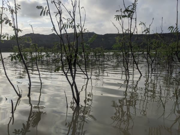
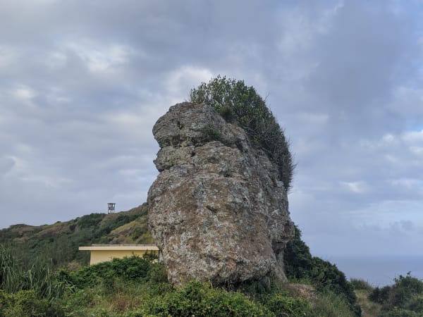
The summit area around the flag tower is open and paved, with clear views in all directions. A trail continues from the tower down into the caldera - the interior is quieter and gives a better sense of the volcanic geology than the summit itself. Hang Câu beach is directly below on the northern side and reachable in a few minutes by motorbike after descending. The climb is not technically difficult but the path has some steep and rocky sections.

🧳 Tips

Núi Thới Lới and Hang Câu are always paired - climb the mountain first, then ride down to the beach for a swim. The eastern side of the island (Tò Vò Gate, Chùa Đục, garlic fields) forms a separate cluster. Most visitors split the island into two half-days along these two natural groupings.

Based on real traveler experiences and commonly mentioned advice from multiple visitors.

Arrive early morning (5am start) to avoid intense summer heat and catch sunrise for unforgettable experience
Use manual transmission motorcycle; check brakes thoroughly before ascending steep, winding road
Bring own food and water; no facilities, services, or trash bins available at summit
Go before sunrise - the ascent takes around 20-30 minutes by foot from the base, and the view at first light over the garlic fields and sea is the best on the island
The road up by motorbike is steep - inexperienced riders should park at the base and walk; the path is manageable on foot
From the summit crater rim, a trail leads down into the caldera interior - worth the extra 15-20 minutes if you want to see the volcanic geology up close
In the rainy season (Oct - Jan), a small waterfall forms on the crater's southern face, cascading down toward Hang Câu beach
The flag tower at the summit is oriented toward the Hoàng Sa Islands - the historical significance of this location is worth understanding before you visit

Common questions from travelers who've visited this place.

Is it safe to visit alone at sunset?
No. Reports document harassment incidents at sunset when few people present. Visit during daytime with groups or early morning for safety.
What vehicle is best for the mountain road?
Manual transmission motorcycles are recommended. Automatic scooters risk brake failure on steep descents due to continuous braking. Inspect brakes before ascending.
When is the best time to visit?
Early morning from 5am for sunrise, cooler weather, and fewer crowds. Afternoon around 3pm offers good photography light. Avoid 8am-4pm in summer due to intense heat.

Explore more things to do like this around Vietnam

Explore more
ly son - Full Guide
View destination guide →