Overview
Things to Know
What Makes Y Tý Special
Y Tý is a highland commune in Bát Xát district, Lào Cai province, sitting above 1,600 metres on the ridgeline close to the Chinese border. It is home primarily to the Hà Nhì people - one of Vietnam's smaller ethnic minorities - whose distinctive earth-walled, short-roofed houses cluster in villages across the terraced hillsides. The landscape is defined by stacked rice terraces carved into steep valleys, dense cloud cover that rolls in from China, and, above everything, the Lảo Thẩn massif rising to 2,860 metres - the highest point in the commune and the 14th-highest peak in Vietnam. Y Tý has been known in Vietnamese travel circles for years as a premier cloud-hunting destination, but it has grown slowly enough to retain the feel of a genuine working highland community rather than a tourist village. For foreign travellers, it offers a combination of trekking, Hà Nhì cultural immersion, and dramatic photography that rivals Sa Pa without the infrastructure or the crowds.
Gallery


How to Get There
🚗 Getting There
Y Tý is approximately 70km from Lào Cai city and 90km from Sa Pa town, with both journeys taking 3–4 hours on winding mountain roads. From Lào Cai, follow the route through Bát Xát town toward Trịnh Tường and continue to Y Tý. From Sa Pa, take the road through Bản Xèo and Mường Hum. Motorbike is the most flexible option and gives access to viewpoints along the way; hired cars are available from both Sa Pa and Lào Cai. There is no reliable public bus to Y Tý - most travellers either rent a motorbike or book a private transfer. Lào Cai city is connected to Hanoi by overnight train (8–9 hours) and sleeper bus.
What to Expect
👀 On the Ground
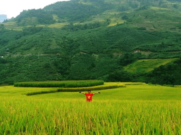
The central attraction of Y Tý is the sea of clouds that pools in the valleys below the ridge on cool mornings, visible from both the commune centre and the surrounding hillsides. In rice season (September–October), the terraced fields turn gold and the combination of cloud, light, and terraces makes for some of the most striking landscape photography in northern Vietnam. Villages like Lao Chai preserve traditional Hà Nhì architecture, and local markets (weekly, day varies) draw communities from across the surrounding hills. The Lảo Thẩn peak trek is a full 2-day commitment involving 5–6 hours of uphill hiking to a mountain hut at around 2,400m, then an early-morning push to the summit for sunrise and the cloud spectacle. The terrain is open grassland rather than dense jungle, making it accessible to fit beginners.
Travel Tips
🧳 Tips
Y Tý rewards travellers who build in at least two nights - one for acclimatisation and exploring the valleys, one for the Lảo Thẩn trek or cloud-hunting at dawn. Pack warm layers even in summer; temperatures drop sharply after sunset at this altitude. The permit requirement for foreigners is real and enforced - don't skip it. Y Tý pairs well with Lũng Pô (40km away, the point where the Red River enters Vietnam) for a border-region day trip, and with Mường Hum market (44km away, Sundays only) for an early-morning ethnic minority market experience.
Insider Tips
Based on real traveler experiences and commonly mentioned advice from multiple visitors.
FAQ
Common questions from travelers who've visited this place.
When is the best time to see clouds at Y Tý?›
Is the road safe for vehicles?›
What food and facilities are available?›
Explore more things to do like this around Vietnam