Overview
Things to Know
What Makes Mũi Cà Mau National Park Special
Mũi Cà Mau National Park encompasses 42,000 hectares at the tip of the Cà Mau Peninsula - the southernmost point of Vietnam's mainland, where the South China Sea on the east and the Gulf of Thailand on the west converge at a point of low mangrove coast and tidal mudflat. The park is a UNESCO Biosphere Reserve and one of the largest remaining mangrove ecosystems in Southeast Asia. The peninsula itself is geologically young and still growing - the Mekong's sediment load continues to extend the coastline southward at a measurable rate each year, and the 'southernmost point' marker has been repositioned as the land advances. The national park protects the mangrove, melaleuca (tràm), and nipa palm forest ecosystems that stabilize the peninsula's coastline and support a significant wildlife community including the Sunda pangolin, fishing cat, and large colonies of migratory waterbirds.
Gallery


How to Get There
🚗 Getting There
Đất Mũi, at the tip of the peninsula, is reached from Cà Mau city by speedboat through the canal and river network - the journey takes approximately 2.5 - 3 hours. Cà Mau city has a domestic airport with flights from Ho Chi Minh City (55 minutes) and Hanoi. By road from HCMC, Cà Mau is approximately 350km - about 6-7 hours via the Mekong Delta expressway. From Cần Thơ, the distance is 180km - about 3-4 hours. Speedboat services from Cà Mau city to Đất Mũi depart in the morning; the return journey means either a same-day turnaround (very rushed) or an overnight at Đất Mũi. Ferry services are slower but cheaper and more atmospheric than the speedboat.
What to Expect
👀 On the Ground
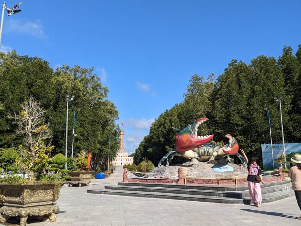
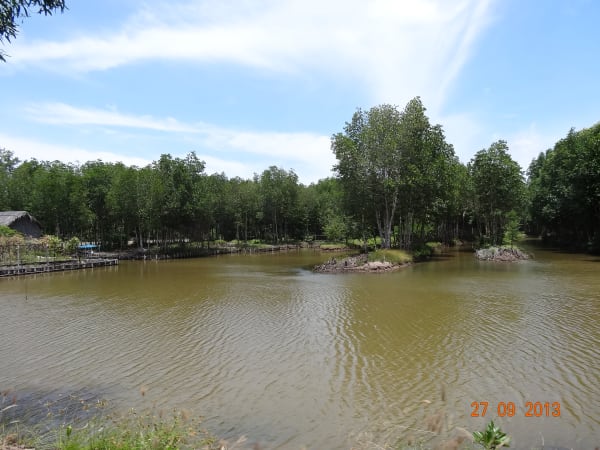
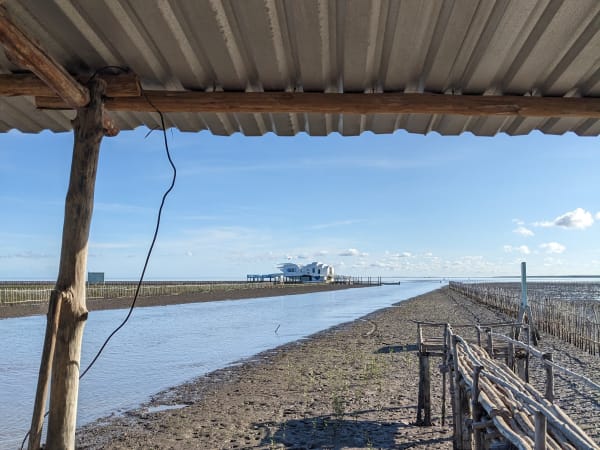
The approach by boat through the mangrove canal system is the defining part of the experience - dense nipa palm and mangrove canopy on both sides, the boat threading through channels that narrow progressively as it approaches the tip. At Đất Mũi, the national landmark monument marks the southernmost coordinate and draws the majority of visitor attention. Walking trails extend through the immediate mangrove area and a viewing tower gives a perspective over the forest canopy. The actual tidal mudflat and meeting of two seas is visible from the outer coast. The wildlife observation quality depends on the guide - organized boat tours into the inner channels with a knowledgeable guide reveal significantly more than the monument area alone.
Travel Tips
🧳 Tips
Mũi Cà Mau has two kinds of appeal: the geographical significance of the southernmost point, which draws Vietnamese visitors on a form of national pilgrimage, and the ecological significance of the mangrove biosphere, which is what makes it worth the journey for nature-oriented travelers. The two can coexist in the same visit but require different amounts of time. If mày is doing a thorough Mekong Delta circuit and has already covered Cần Thơ, Châu Đốc, and the mainstream delta, Cà Mau and Đất Mũi are the logical extension south - genuinely remote, genuinely different in character from the rest of the delta, and carrying the specific satisfaction of reaching the physical end of the country.
Insider Tips
Based on real traveler experiences and commonly mentioned advice from multiple visitors.
FAQ
Common questions from travelers who've visited this place.
How do I reach Mui Ca Mau National Park?›
What wildlife can I see here?›
Is there food available at the park?›
Nearby Locations
Explore more things to do like this around Vietnam