Overview
Things to Know
What Makes Minh Đạm Mountain Special
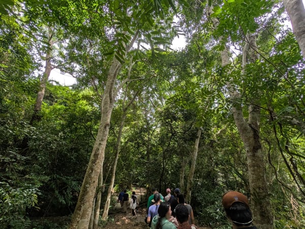
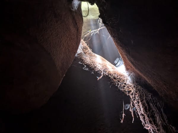
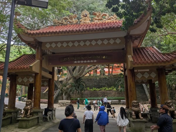
Minh Đạm Mountain rises from the coastal lowlands of Đất Đỏ district in Bà Rịa-Vũng Tàu province, its forested slopes overlooking the southeastern coast between Long Hải and Hồ Tràm. The mountain served as a resistance base during both the French colonial period and the American war - its dense forest cover, cave systems, and coastal position made it a defensible refuge for revolutionary forces operating in the region for decades. The caves and tunnels within the mountain were used as hospitals, meeting rooms, and supply depots; several are accessible to visitors today and the site has been designated a national historical relic. The combination of forest trekking, cave exploration, and war history makes Minh Đạm one of the more textured day trip options in a province better known for beach resorts.
Gallery


How to Get There
🚗 Getting There
Minh Đạm Mountain is located in Phước Hải commune, Đất Đỏ district, approximately 100km from Ho Chi Minh City and 30km from Vũng Tàu city. By car or motorbike from HCMC, follow Highway 51 toward Vũng Tàu then branch south toward Long Hải and Phước Hải - the journey takes around 2 hours. From Vũng Tàu, the drive is about 30 minutes along the coastal road toward Long Hải. The entrance to the site is signposted from the road through Phước Hải village.
What to Expect
👀 On the Ground
A trail from the entrance climbs through secondary forest to the cave complex and summit area. The caves are low and narrow in sections - a torch is useful and a guide is recommended for the underground portions. Historical markers, preserved equipment, and information panels explain the site's wartime role. The forest trail above the caves continues to the summit viewpoint where the coast is visible in both directions. The overall climb is moderate - suitable for most fitness levels with appropriate footwear. The site sees relatively few foreign visitors and the historical interpretation is primarily in Vietnamese.
Travel Tips
🧳 Tips
Minh Đạm offers a version of wartime history that differs from the heavily visited Cu Chi Tunnels near HCMC - the site is smaller, quieter, and embedded in a natural landscape rather than a managed tourist complex. For travellers interested in the resistance movement beyond the standard HCMC circuit, the mountain provides a more contemplative experience of the same history. The coastal location means it combines naturally with the beaches of Long Hải and Hồ Tràm, which are among the closest decent beach options to HCMC and significantly less developed than Vũng Tàu.
Insider Tips
Based on real traveler experiences and commonly mentioned advice from multiple visitors.
FAQ
Common questions from travelers who've visited this place.
Can I drive to the mountain summit?›
Is it safe to visit due to monkeys?›
Which route should I follow to avoid getting lost?›
Nearby Locations
Explore more things to do like this around Vietnam