Menu
ProvincesLocationsExperiencesBlogMap
📍 mountain · attraction · nature · ha giang loop

Mã Pí Lèng Pass

Mã Pí Lèng Pass - Vietnam's most dramatic mountain road, a 20km switchback carved into sheer limestone cliffs above the turquoise Nho Quế River canyon, 1,500m below.

🏍️ Motorbike🏔️ Mountain Pass📸 Photography🌊 Canyon Views
🧭 Get Directions
Best Time to Visit
📅 Sep – Nov (golden rice terraces) or Mar – Apr (spring blossoms)
Entry Fee
🎟️ Free
Opening Hours
🕐 Open 24/7 - best at sunrise
Address
📌 Mã Pí Lèng, Mèo Vạc, Hà Giang
👥Crowds
Popular tourist spot with narrow paths; expect small children asking for money at viewpoint
🥾Difficulty
Extremely challenging terrain with significant altitude (1,500m). Wrong moves on narrow paths result in fatal consequences. Not recommended by bike for inexperienced riders
⚠️Safety
Extreme heights with sheer cliffs and 1,500m drop-offs. Skywalk area particularly dangerous; main Highway 4C road safer. Avoid purchasing items sold roadside (counterfeit mushrooms reported)
🚶Accessibility
Not easily accessible; requires climbing to reach top. Narrow paths become even more constrained when crowded
🌤️Seasonal
Best visited in clear weather. Spring recommended for viewing blossoms on mountainside

What Makes Mã Pí Lèng Pass Special

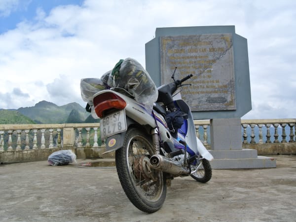
Mã Pí Lèng is widely considered the most spectacular mountain pass in Vietnam - a 20km stretch of the Happiness Road clinging to sheer limestone cliffs above the Nho Quế River gorge. At the summit, the road reaches 1,500m and the canyon drops almost vertically to the turquoise river below. The scale is genuinely staggering. It connects Đồng Văn to Mèo Vạc and is the centerpiece of the Hà Giang Loop.

🚗 Getting There

Mã Pí Lèng Pass is on the road between Đồng Văn and Mèo Vạc - about 20km from each town. Most travelers ride through it as part of the Hà Giang Loop, approaching from Đồng Văn going east toward Mèo Vạc. The pass itself takes 30–45 minutes to cross at a comfortable pace with stops. From Hà Giang city, Đồng Văn is about 4.5 hours by motorbike.

👀 On the Ground

The road winds through dramatic karst landscape before the canyon opens up suddenly on the descent toward Mèo Vạc. The summit viewpoint has a small café and a cluster of souvenir stalls. The view down into the Nho Quế gorge is the defining image of northern Vietnam - turquoise water threading between vertical limestone walls thousands of metres high. The road surface is generally good but narrow, with sheer drops on one side and no barriers.

🧳 Tips

Most people ride through Mã Pí Lèng as part of a 3–4 day Hà Giang Loop starting and ending in Hà Giang city. Renting a semi-auto motorbike in Hà Giang costs 150,000–200,000 VND/day. If you're not confident riding mountain roads, hiring an Easy Rider guide from Hà Giang is a safer option. The pass is equally spectacular in both directions - Đồng Văn to Mèo Vạc gives the best canyon views on the right-hand side going down.

Based on real traveler experiences and commonly mentioned advice from multiple visitors.

Hire an easy rider or professional driver to navigate hairpin turns safely and enjoy views without distraction
Visit main Highway 4C road between Mèo Vạc and Đồng Văn instead of Google Maps pin location (skywalk area)
Book boating tour on Nho Que river (120,000 VND per person, 20,000 VND per camera) for complete experience
The viewpoint at the summit has a café - stop here for coffee and the best unobstructed view down into the Nho Quế canyon
The road is narrow with no guardrails in places - go slowly, especially on blind corners
Morning light hits the canyon best - arrive at the summit between 7–9am
The road gets slippery in rain and fog - check the weather before riding in wet season
The Happiness Road (Đường Hạnh Phúc) through Mã Pí Lèng was built by hand by ethnic minorities in the 1960s - one of Vietnam's great engineering feats

Common questions from travelers who've visited this place.

Is it safer to ride motorbike or hire a driver?
Hiring an easy rider or professional driver is recommended. Motorbikes require expertise with hairpin turns and cliff edges; wrong moves result in fatal consequences.
Where exactly is Mã Pí Lèng Pass located?
Highway 4C in Hà Giang province, approximately 20km connecting Đồng Văn and Mèo Vạc towns. Google Maps pin is incorrect; it points to dangerous skywalk area.
What is the highest elevation and best viewpoint?
Pass highest point is 1,200m, but many confuse it with the popular Visitor Center photostop at 3.5km north. Main road offers best views of the Nho Que river canyon.
Explore more
ha giang loop - Full Guide
View destination guide →