There's a particular kind of pride that comes from touching every corner of your own country.
Not from a plane window. Not from a tour bus. But slowly, on two wheels, through mountain passes and muddy tracks and coastal highways - until you've stood at the northernmost flagpole, the westernmost border stone, the southernmost mudflat, and the easternmost cliff, and you know in your bones that you've traced the full shape of the land.
Vietnamese riders call it "4 cuc 1 dinh 2 nga 3" - four extremes, one summit, two tri-border points. It's not an official route. There's no stamp, no certificate, no finish line. But in the Vietnamese long-distance riding community (known as phuot - a culture of long-distance exploration by motorbike), completing it carries a weight that's hard to explain to outsiders.
It means you've gone to every edge. You've seen the whole country.
This is that route - in two versions. Thirty days. One Yamaha Sirius. And a feeling I'm still carrying.
What Is the "4 Extremes, 1 Summit, 2 Tri-Borders" Route?
Vietnam is shaped like an elongated S, stretching nearly 1,650km from north to south. For Vietnamese people, the borders of that shape are not just geographic coordinates. They are hard-won. The land was divided, fought over, and reunified within living memory. Every border marker carries history.
The route visits seven specific points:
The four extremes:
- Northern extreme - Lung Cu flagpole, Ha Giang
- Southern extreme - Dat Mui, Ca Mau
- Eastern extreme - Mui Doi / Mui Dien, Phu Yen & Khanh Hoa
- Western extreme - A Pa Chai, Dien Bien
The one summit:
- Fansipan - the Roof of Indochina at 3,143m, Lao Cai
The two tri-border points:
- A Pa Chai - where Vietnam, Laos, and China meet (also the western extreme)
- Ngoc Hoi - where Vietnam, Laos, and Cambodia meet, Kon Tum
None of these places appear in most travel guides. But among Vietnamese riders, they are the most significant locations in the country - not for their scenery, but for what they represent.
Why Vietnamese Riders Consider This Route Sacred
Before I left, I told an older friend I was planning to ride across Vietnam - the whole thing, every edge. He nodded and said: "Go. Go so you know what shape our country is."
I didn't fully understand what he meant until I was standing at A Pa Chai.
To understand this route, you need to understand something about Vietnamese culture that most travel writing misses entirely.
Vietnamese people are deeply attached to the concept of territorial integrity - the idea that every centimeter of the country's land belongs to the nation and must be protected. This isn't abstract nationalism. It comes from lived history: wars fought on this exact soil, borders contested within living memory, maps redrawn by force and redrawn again.
When Vietnamese riders visit the border markers, they're not sightseeing. They're making a statement.
Photographing yourself at a border stone with the Vietnamese flag is an act of claiming - I was here, at the edge of our country, and I touched it with my own hands. The phuot (long-distance riding) community has formalized this into a challenge: collect all the extremes, prove you've been to every edge.
At Lung Cu, I watched an older Vietnamese man stand at the stone marker for a long time without taking a photo. He wasn't documenting. He was absorbing.
At Dat Mui, standing at the southern tip of the country, I felt something I struggle to articulate in English. Something like gratitude. For the land, for the generations who kept it, for the chance to see it whole.
Thank you to the generation before.
That feeling - that combination of pride, gratitude, and something approaching reverence - is what this route is really about. Keep it in mind as you ride.
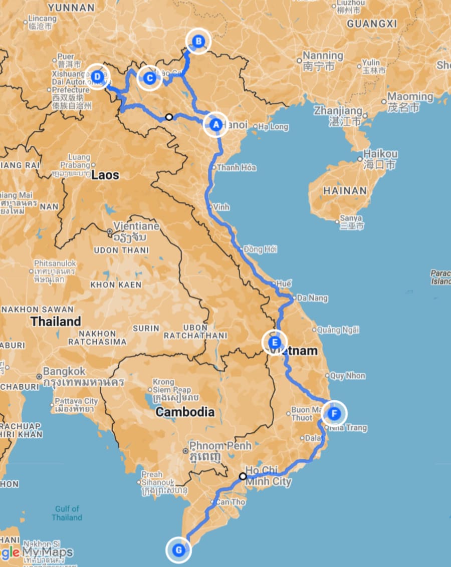
The 412 - The Core Challenge
Distance: ~5,500–6,500km Duration: 25–30 days Start/End: Hanoi
Hanoi
→ Lung Cu (Ha Giang) - Northern extreme
→ Fansipan (Lao Cai) - Highest summit
→ A Pa Chai (Dien Bien) - Western extreme + Tri-border 1
→ Hanoi [rest stop]
→ Ngoc Hoi (Kon Tum) - Tri-border 2
→ Mui Doi / Mui Dien (Phu Yen / Khanh Hoa) - Eastern extreme
→ Ho Chi Minh City
→ Dat Mui (Ca Mau) - Southern extreme
This is the core challenge - The 412 - all four extremes, one summit, two tri-border points. It covers Vietnam's most demanding terrain and most remote access points. Most riders complete it in 25–30 days at a pace that allows for rest and genuine experience at each location.
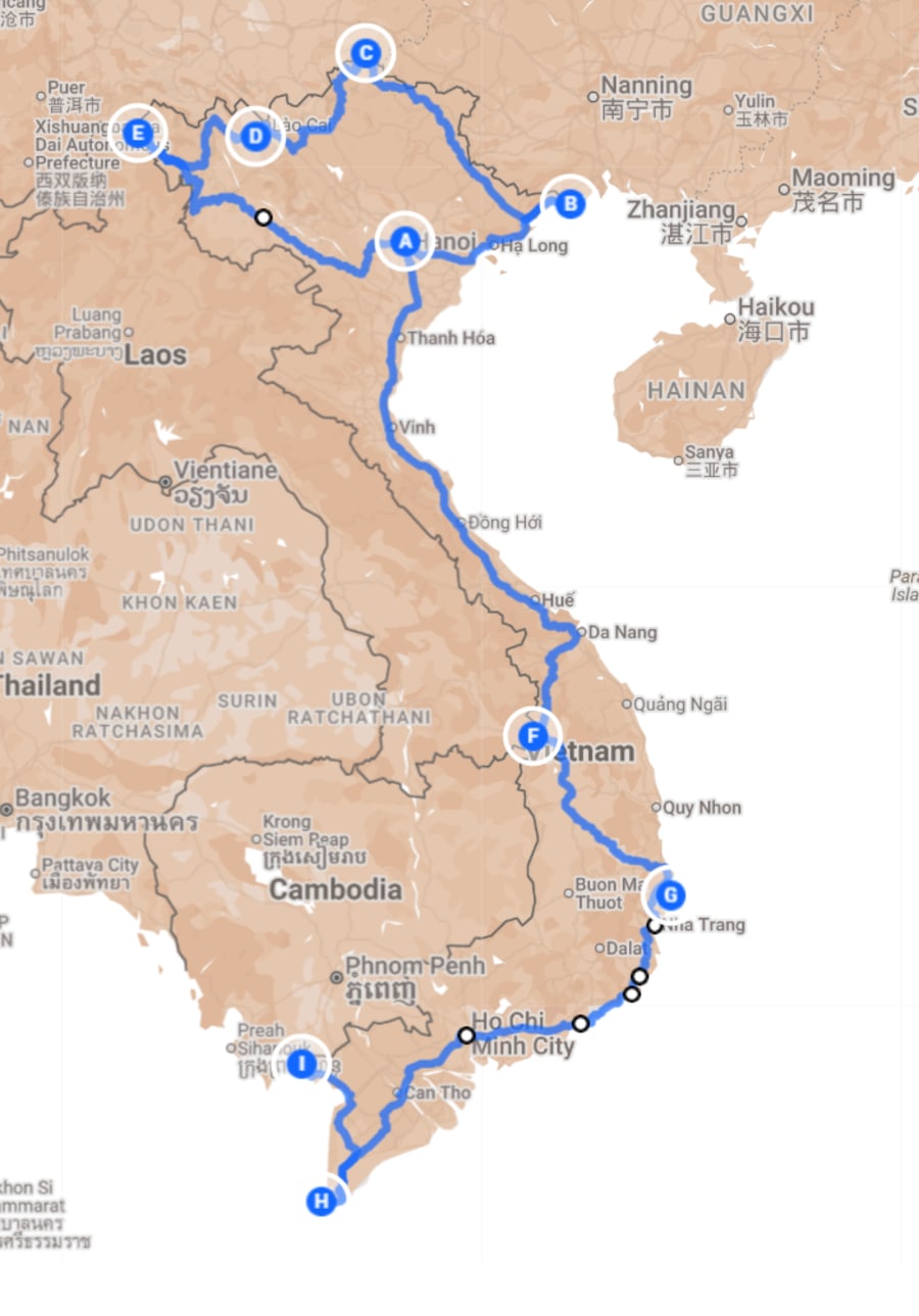
The 4122 - The Complete S-Curve
Distance: ~6,500–8,000km Duration: 30–40 days Start/End: Hanoi → Ha Tien (one-way)
Hanoi
→ Tra Co (Mong Cai, Quang Ninh) - Start of the S
→ Lung Cu (Ha Giang) - Northern extreme
→ Fansipan (Lao Cai) - Highest summit
→ A Pa Chai (Dien Bien) - Western extreme + Tri-border 1
→ Hanoi [rest stop]
→ Ngoc Hoi (Kon Tum) - Tri-border 2
→ Mui Doi / Mui Dien (Phu Yen / Khanh Hoa) - Eastern extreme
→ Ho Chi Minh City
→ Dat Mui (Ca Mau) - Southern extreme
→ Ha Tien (Kien Giang) - End of the S
This version adds two points that transform the route from a challenge into something closer to a pilgrimage.
Tra Co (Mong Cai) is the northeasternmost point of Vietnam's coastline - the place where the country's long shoreline begins. Ha Tien is where it ends, at the southwestern corner near the Cambodian border.
Together, they represent the first and last strokes of the pen that draws Vietnam's S-shaped outline. Start at Tra Co and finish at Ha Tien and you haven't just visited the extremes - you've traced the full shape of the country, coast to coast, tip to tip.
This is the version I rode - The 4122. It takes longer and requires more planning, but the sense of completion at Ha Tien is different from anything I've experienced on a motorbike.
The Easternmost Point: Mui Doi vs Mui Dien
This deserves its own section because it causes genuine confusion - and because the answer matters for how you plan this leg.
Mui Doi is Vietnam's true geographic easternmost point - the easternmost point of mainland Vietnam. Reaching it requires either a boat ride or a significant overland trek. There is no road to the actual point. Most Vietnamese riders who claim the eastern extreme go to Mui Doi.
Mui Dien (Cape Varella) is in Phu Yen province, just north of Mui Doi. It has a working lighthouse, is accessible by motorbike track, and offers dramatic coastal scenery. Mui Dien is often incorrectly labeled as Vietnam's easternmost point - it is not, but it's the more practical destination for most riders.
The honest answer: if you want to claim the eastern extreme accurately, go to Mui Doi - plan for the boat or the trek. If you want the accessible version with a lighthouse and great views, Mui Dien is the call. They're close enough to visit both on the same leg.
Why Small Bikes Win on This Route
I rode a Yamaha Sirius for the entire trip. 115cc. Modest power. Nothing that would impress anyone at a bike shop.
And I'd recommend it over a large bike without hesitation.
Adventure motorbike content tends to fetishize displacement - the Honda CRF, the Royal Enfield, the big Minsk. There's a whole aesthetic around it. But for this specific route, across Vietnam's actual roads, a small bike has practical advantages that don't get talked about enough:
You can push it through. On the road to A Pa Chai, there are sections that aren't really roads - rocky tracks, muddy slopes, stream crossings. When the path gets rough, you may need to push or help the bike through on foot. A 100kg+ adventure bike doesn't move easily in those conditions. A Sirius does.
Anyone can fix it. Break down on a remote mountain road in the northwest and your exotic adventure bike becomes a very expensive problem. A Sirius breaks down in the same place and any mechanic in any village in Vietnam can fix it with parts they have on the shelf. And there are mechanics in every village in Vietnam.
It doesn't attract attention. A foreigner on a flashy big bike in remote border areas draws a different kind of attention than a regular-looking commuter bike. Blending in has real advantages.
It's honest. The Vietnamese long-distance riding community has always been about the journey, not the machine. The most experienced riders often choose small bikes deliberately - not because they can't afford better, but because they understand what the road actually asks of you.
You won't feel the rush of torque on an open highway. But you'll get somewhere closer to the real thing.
If renting, prioritize a well-maintained small bike with recent service records over a flashier bike with unknown history. The Sirius and Honda Wave are the easiest to service anywhere in Vietnam - parts are available in the smallest towns.
The Stops in Detail
Tra Co - Where the Coastline Begins
Location: Mong Cai, Quang Ninh Route 4122 only
Tra Co is a long, quiet beach - one of Vietnam's longest at nearly 17km. The border with China is visible from the shore. The atmosphere at the northeastern marker is understated: fewer tourists, more local fishermen, the smell of salt and diesel from the fishing boats.
Most riders breeze past Mong Cai on the way to Ha Giang. Don't. Standing at Tra Co knowing you'll finish at Ha Tien - that you're about to trace the entire coastline - changes the quality of every kilometer that follows.
Practical notes:
- From Hanoi: ~340km via Ha Long, full day of riding
- No permit required
- Accommodation: Mong Cai town has good options
Lung Cu - Vietnam's Northernmost Point
Location: Dong Van, Ha Giang
The sky was blue and cold when I got there. The kind of blue you only get at altitude when the air is completely clear.
Lung Cu wasn't crowded that day - a handful of other riders, a few tourists. But there was a particular feeling in the air that I've only encountered at places people treat as sacred. People spoke more quietly than usual. They photographed the flagpole slowly, deliberately.
The flagpole stands on top of Dragon Mountain - about 800 steps from the parking area. The Vietnamese flag at the top is enormous, maintained and replaced regularly. Standing beneath it, looking north into China and south into the karst valleys of Ha Giang, you understand the weight of the place.
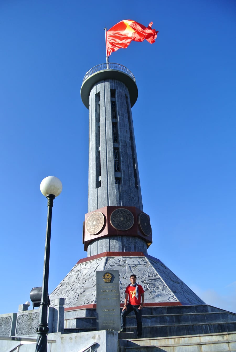
Practical notes:
- From Dong Van town: ~24km, 45 minutes on mountain roads
- No permit required
- Entry fee: ~20,000 VND
- Best visited early morning for clearest skies
- The Ha Giang Loop passes nearby - combine if you have extra days
Fansipan - The Roof of Indochina
Location: Sa Pa, Lao Cai Elevation: 3,143m
The cable car exists. It's impressive infrastructure. But for a journey about earning every point - the trek matters.
The full trek from Tram Ton pass takes 2–3 days depending on conditions and fitness. It's not technically difficult, but it's relentless. Summit visibility can be zero in cloud season. Go in October or November for the best chance of clear skies.
Practical notes:
- Trek: 2–3 days, hire a local guide from Sa Pa
- Cable car: 15 minutes, runs daily
- Best season: October–November
- No permit required for trekking with a licensed guide
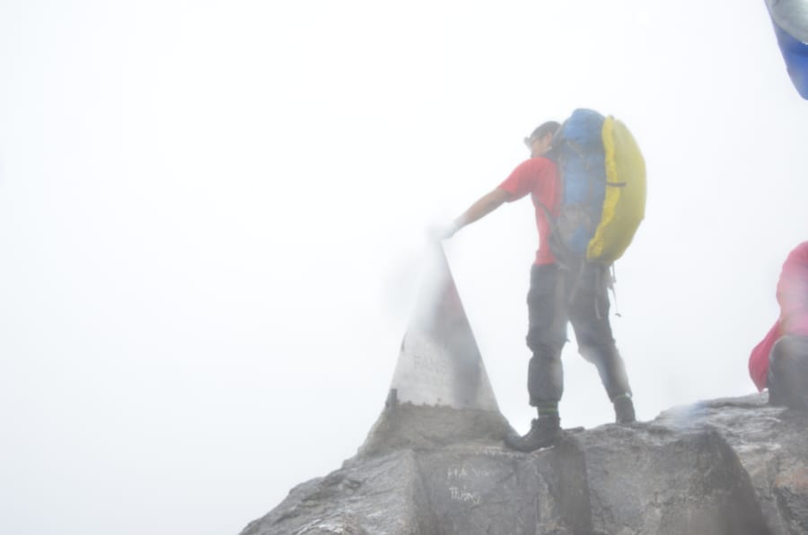
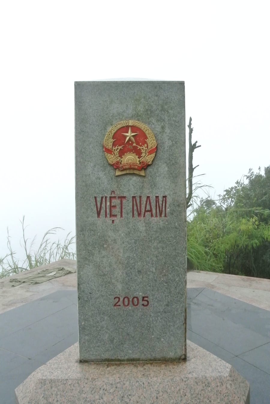
A Pa Chai - The Western Extreme & Vietnam-Laos-China Border
Location: Muong Nhe, Dien Bien
This is the hardest point to reach on the entire route. It is also the most powerful.
A Pa Chai sits in Muong Nhe district - one of the most remote areas in Vietnam. The road from Dien Bien Phu deteriorates significantly in the final stretch. In wet season, sections become impassable.
At the tri-border marker, three countries meet at a single stone pillar. You can walk around it in ten steps and stand in three countries. The stone is engraved with the markers of each nation.
There's a saying among Vietnamese riders about places like this: "Nơi mà một con gà gáy, cả 3 nước đều nghe" - where one rooster crows, three countries hear it. Standing here, you understand exactly what that means.
When I arrived, there were two other Vietnamese riders already there. We didn't say much. One of them had ridden from Hanoi - this was his second visit. He said he came back because the first time he couldn't fully absorb it. I understood immediately.
Permit requirement: Border area permit required. Apply at the Border Guard Command in Dien Bien Phu city. Bring your passport. Processing: usually same-day.
Practical notes:
- From Dien Bien Phu: ~180km, full day
- Road: sealed to Muong Nhe, rough track to the border
- Best season: October–April
- Nearest accommodation: Muong Nhe town
Do not attempt A Pa Chai without the border permit. Border guards are stationed throughout the area and enforcement is consistent. Being turned back after a full day of riding is entirely avoidable with 30 minutes of paperwork in Dien Bien Phu.
Hanoi Rest Stop
After A Pa Chai, return to Hanoi before heading south. Take two days: service your bike, rest your body, eat well. The south requires a different kind of endurance - longer flat distances, heat, traffic. You've done the hardest terrain. Don't underestimate the second half.
Ngoc Hoi - Vietnam-Laos-Cambodia Tri-Border Point
Location: Ngoc Hoi district, Kon Tum
The Central Highlands feel completely different from the northern mountains. Lower, greener, broader. The roads through Kon Tum province are some of the least-traveled in Vietnam - long stretches without traffic, small ethnic minority villages, the occasional military checkpoint.
The tri-border point at Bo Y international border gate is more accessible than A Pa Chai but requires similar documentation. Three countries. One point.
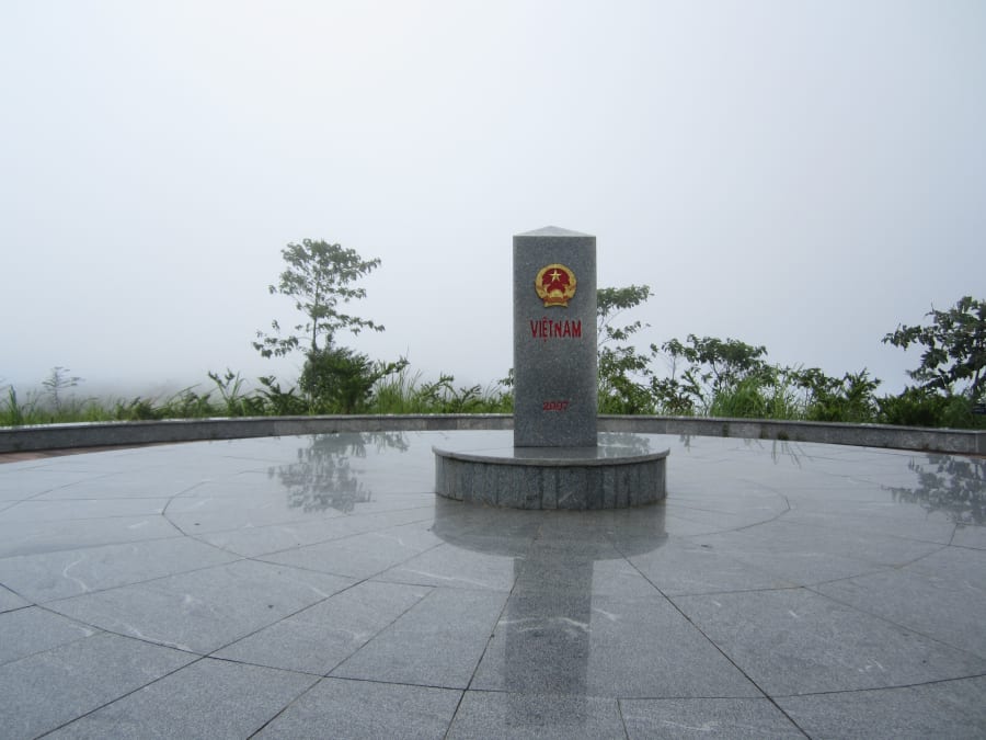
Permit requirement: Border area permit required. Apply in Kon Tum city before heading to Ngoc Hoi.
Practical notes:
- From Kon Tum city: ~70km, well-paved
- Bo Y has visitor infrastructure - easier access than A Pa Chai
Mui Doi & Mui Dien - Vietnam's Eastern Extreme
Location: Phu Yen & Khanh Hoa provinces
The descent from the Central Highlands to the coast is one of the most dramatic transitions of the entire route - temperature rising, landscape opening, the sea appearing on your right.
Mui Doi is the true easternmost point (boat or trek required). Mui Dien has the lighthouse and is accessible by motorbike track. Visit both - they're close enough to combine in one day.
Practical notes:
- No permit required
- Phu Yen has excellent, uncrowded beaches for overnight stops
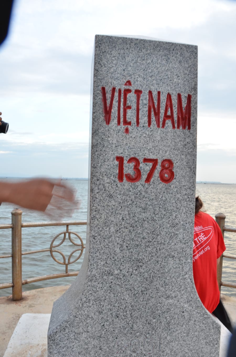
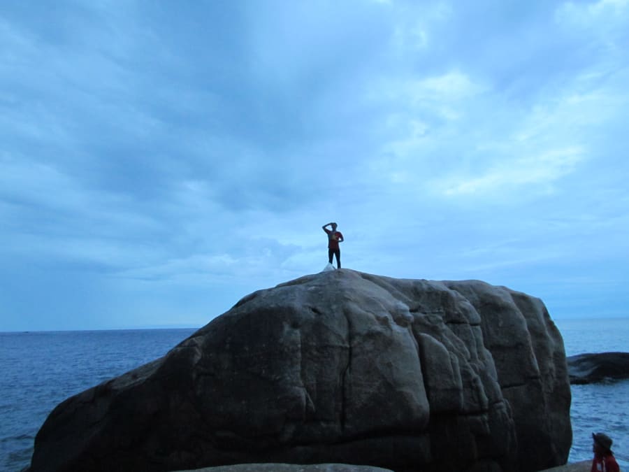
Dat Mui - Vietnam's Southernmost Point
Location: Ngoc Hien district, Ca Mau
Dat Mui is where the country ends. The land runs out into mangrove forest and then sea. The southernmost monument is one every Vietnamese person recognizes from school textbooks.
Getting there from Ho Chi Minh City means crossing the Mekong Delta - ferries, narrow roads through rice paddies, the flat green immensity of the south. It's a different Vietnam from everything that came before on this route.
At the monument, I thought about the man at Lung Cu who stood quietly without taking a photo. I did the same.
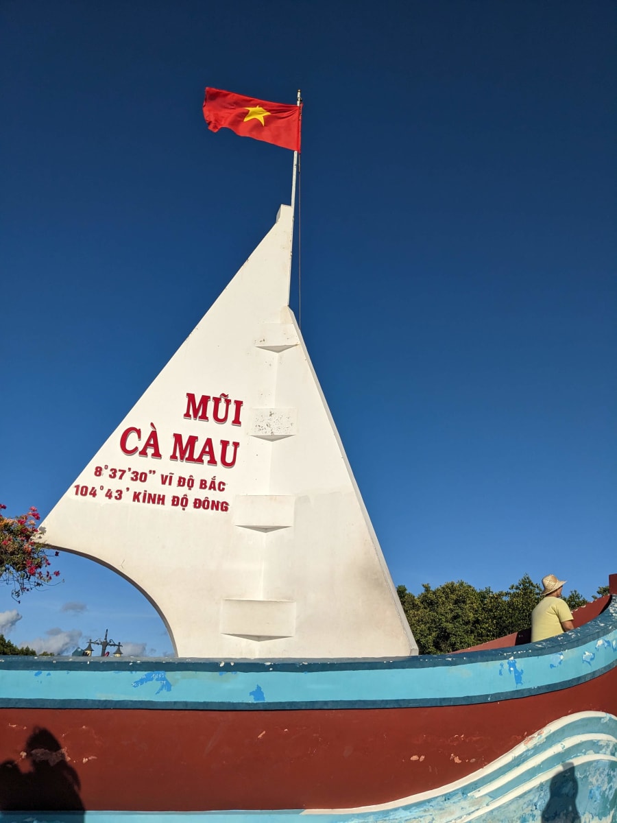
Practical notes:
- From Ca Mau city: ~100km by road to the national park, then electric car or boat through the park
- Allow a full day for the round trip
- No permit required
Ha Tien - The End of the S-Curve
Location: Kien Giang, near the Cambodian border Route 4122 only
Ha Tien is a small coastal town near the Cambodian border in Vietnam's far southwest. From here, you can look back across the Gulf of Thailand and know that somewhere to the northeast - more than 3,000km away - is Tra Co, where you started.
You've traced the S. Coast to coast, tip to tip.
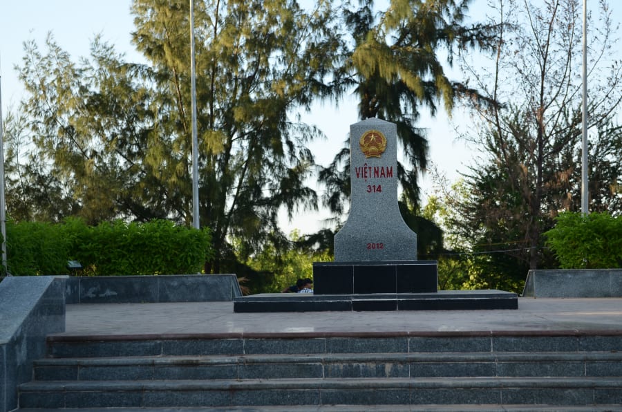
You've reached the end of Vietnam... and the road continues.
The Xa Xia border crossing to Cambodia is ~10km from Ha Tien town - one of the quietest land crossings in Southeast Asia. If your Vietnamese visa is expiring (the standard 30-day free visa lines up almost perfectly with this route), crossing here is the most natural next step.
From Xa Xia: Kampot is 2–3 hours, Phnom Penh about 5 hours. Cambodia visa on arrival is available for most nationalities ($30 USD), or apply for an e-visa in advance at evisa.gov.kh.
If you are riding a rental motorbike, note that most rental agreements do not permit crossing international borders. Check your rental contract before planning to continue into Cambodia by bike. Many riders leave their bike in Ha Tien and cross on foot or by bus.
By the time you reach Ha Tien, you've crossed mountains, borders, rivers, and coastlines. You've touched every edge of the map.
Practical Guide
Best Time to Ride
| Season | Northern Mountains | Central / Highlands | South |
|---|---|---|---|
| Oct – Dec | ✅ Best | ✅ Good | ✅ Dry season begins |
| Jan – Mar | ✅ Good | ✅ Good | ✅ Dry season |
| Apr – May | ⚠️ Getting hot | ✅ OK | ⚠️ Getting hot |
| Jun – Sep | ❌ Peak monsoon | ⚠️ Mixed | ❌ Wet season |
Recommended: Start in October. The north is post-monsoon and clear. The south is entering dry season. A Pa Chai is passable. Fansipan has good visibility windows.
Permits Summary
| Location | Permit Required | Where to Apply |
|---|---|---|
| A Pa Chai | Yes | Border Guard HQ, Dien Bien Phu |
| Ngoc Hoi tri-border | Yes | Kon Tum city |
| Lung Cu | No | - |
| Fansipan | No (with guide) | - |
| Mui Doi / Mui Dien | No | - |
| Dat Mui | No | - |
| Tra Co | No | - |
| Ha Tien | No | - |
Budget Estimate
| Category | Per Day |
|---|---|
| Accommodation | 150,000–250,000 VND |
| Food | 100,000–150,000 VND |
| Fuel (small bike) | 50,000–80,000 VND |
| Misc (entry fees, permits) | 30,000–50,000 VND |
| Total | ~330,000–530,000 VND/day |
30-day total: 10–16 million VND (excluding bike)
Bike Options
Buy and resell: Budget bikes in Hanoi sell for 5–8 million VND. Resell in Ho Chi Minh City for similar prices. If you plan to cross into Cambodia at Ha Tien, you can sell the bike in Ha Tien or Ho Chi Minh City before the border. Best value for 30+ days.
Rent: 100,000–150,000 VND/day from reputable shops in Hanoi. Check service records, not just appearance. Note that most rental contracts do not allow crossing international borders.
What to carry: Tire repair kit, spare spark plug, basic spanners, a pump. Know how to change a tire. Everything else can be fixed roadside.
Safety Notes
- Always wear a helmet - full-face for mountain roads
- Mountain roads in the northwest have no guardrails on many sections. Ride at a pace that lets you stop
- Tell someone your daily itinerary when riding remote sections
- Keep your phone charged - offline maps (Maps.me or Google Maps offline) are essential
- Carry basic first aid supplies
Frequently Asked Questions
How long does the route take?
The 412 (core): 25–30 days minimum. The 4122 (S-curve): 30–40 days. These are minimums - rushing defeats the purpose of the route.
Do foreign riders need permits for the border areas?
Yes. Both A Pa Chai and the Ngoc Hoi tri-border point require border area permits for all visitors, foreign or Vietnamese. Apply in Dien Bien Phu and Kon Tum city respectively, with your passport. Processing is usually same-day.
Can I cross into Cambodia from Ha Tien?
Yes. The Xa Xia border crossing is ~10km from Ha Tien town and is open to foreign travelers. Cambodia visa on arrival is available for most nationalities ($30 USD), or apply for an e-visa in advance at evisa.gov.kh. Note that most rental motorbikes cannot legally cross the border - many riders leave their bike in Ha Tien and cross on foot or by bus.
What motorbike should I use?
A well-maintained small bike - Yamaha Sirius or Honda Wave - is the practical choice for this route. See the full reasoning in the bike section above.
Can a beginner do this route?
Not recommended. This route includes remote mountain tracks, challenging road surfaces, and border area sections that require genuine riding experience. Be comfortable on a manual motorbike in mixed conditions before attempting this.
Is A Pa Chai worth the extra effort?
Without question. It is the most logistically demanding point on the route and the most powerful when you arrive. Do not skip it.
Can I do this route without speaking Vietnamese?
You can, but the permit process in Dien Bien Phu and Kon Tum will be harder without Vietnamese. Basic phrases help significantly. A translation app is essential in remote areas.