There's a particular kind of satisfaction that comes from finishing something you didn't have to start.
Not a tour. Not a package. Just a map, a motorbike, and a question: have I actually seen all nine of them?
The Mekong River travels nearly 5,000 kilometers before it reaches Vietnam. It begins on the Tibetan Plateau, flows through China, Myanmar, Laos, Thailand, and Cambodia - and when it finally crosses into Vietnam, it doesn't arrive as one river.
It arrives as many.
Spreading across the flat southern delta, the Mekong splits into a web of channels, distributaries, and tributaries before finally meeting the South China Sea. At its edge, it pushes out through nine separate mouths - nine places where river becomes ocean.
The Vietnamese have a name for this. They call the river Cửu Long (九龍) - the Nine Dragons.
I grew up near this region. I knew the name my whole life. But one day I realized I'd never actually seen all nine of them. So I got on my motorbike and went to find every single one.
What I discovered along the way was that the Nine Dragons are not quite what the name suggests. Rivers change. Channels silt up. Dams get built. The story of the Mekong Delta's nine mouths is also a story about how a river - and the people who live beside it - adapt to time.
Why Is the Mekong Called the Nine Dragons?
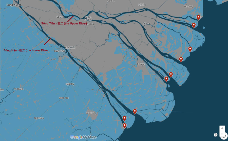
The "Nine Dragons" refers to the nine river mouths of the Mekong as it flows into the South China Sea in southern Vietnam. These branches form the Mekong Delta - one of the most fertile and densely populated regions in Southeast Asia. In Vietnamese, cửu means nine and long means dragon, giving the river its poetic name: Cửu Long (九龍).
When the Mekong crosses into Vietnam from Cambodia, it splits into two main branches:
- Sông Tiền (the Upper River) - the northern branch, flowing through Tiền Giang and Bến Tre
- Sông Hậu (the Lower River, or Bassac) - the southern branch, flowing through Vĩnh Long, Cần Thơ, and Sóc Trăng
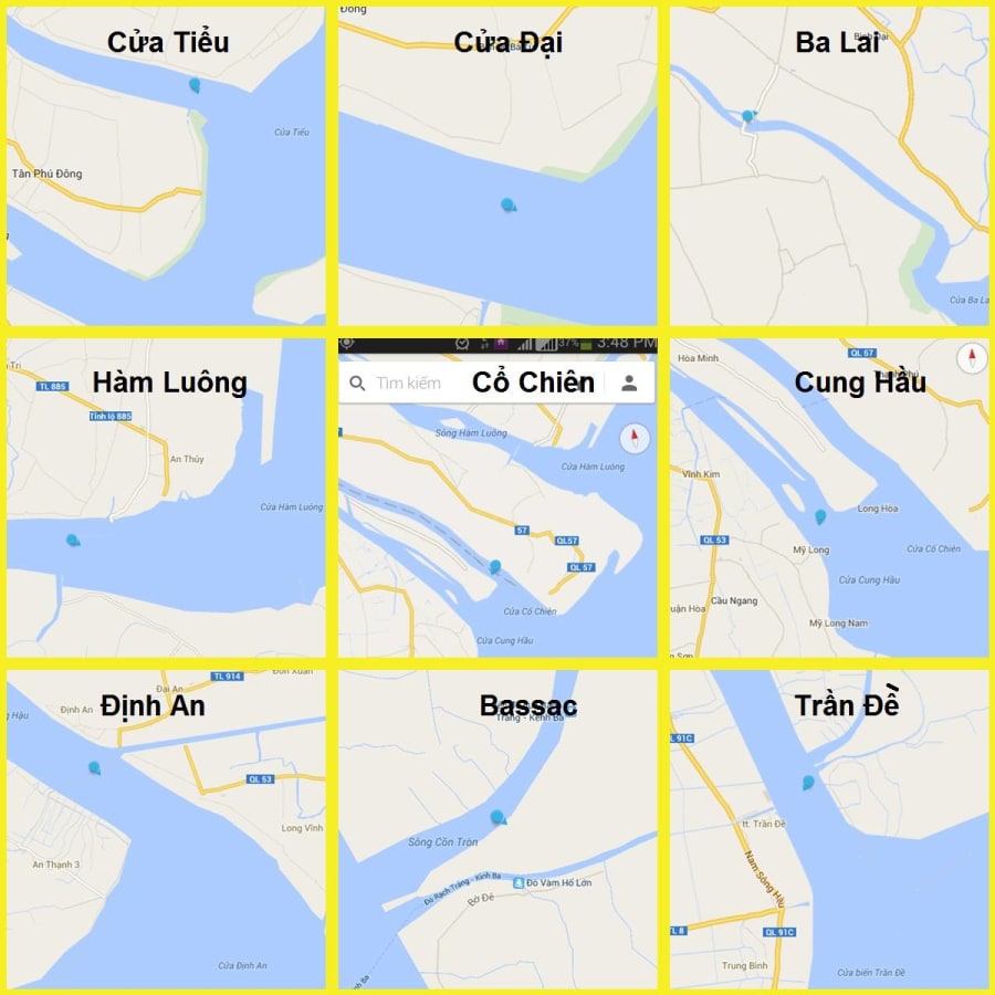
These two branches then fan out further, creating nine river mouths along Vietnam's southeastern coastline:
| # | River Mouth | Province | Status |
|---|---|---|---|
| 1 | Cửa Tiểu (Tieu Mouth) | Tiền Giang | ✅ Active |
| 2 | Cửa Đại (Dai Mouth) | Tiền Giang / Bến Tre | ✅ Active |
| 3 | Cửa Ba Lai (Ba Lai Mouth) | Bến Tre | ⚠️ Dammed |
| 4 | Cửa Hàm Luông (Ham Luong Mouth) | Bến Tre | ✅ Active |
| 5 | Cửa Cổ Chiên (Co Chien Mouth) | Bến Tre / Trà Vinh | ✅ Active |
| 6 | Cửa Cung Hầu (Cung Hau Mouth) | Trà Vinh | ✅ Active |
| 7 | Cửa Định An (Dinh An Mouth) | Trà Vinh / Sóc Trăng | ✅ Active |
| 8 | Cửa Ba Thắc (Ba Thac / Bassac Mouth) | Sóc Trăng | ❌ Silted up |
| 9 | Cửa Trần Đề (Tran De Mouth) | Sóc Trăng | ✅ Active |
Nine mouths. Nine dragons breathing into the South China Sea.
Except - not quite anymore. But more on that later.
Exploring the Mekong Delta's Nine River Mouths: The Route
Most travelers who visit the Mekong Delta see one or two river mouths without even realizing it. They take a boat tour from Mỹ Tho or Cần Thơ, drift through some channels, eat fresh fruit on a sampan, and leave satisfied.
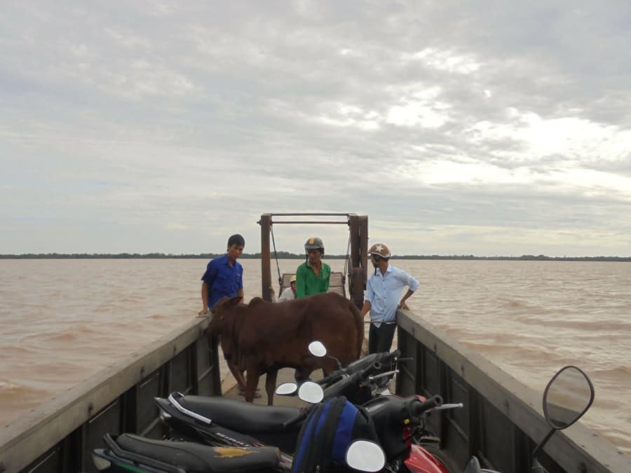
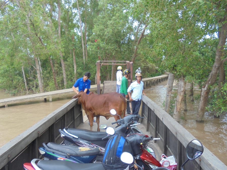
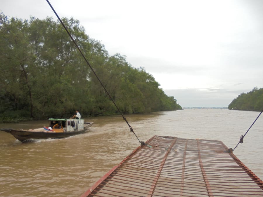
I wanted to see all nine. Not from a boat - from a motorbike, riding the coastal roads from mouth to mouth, loading my bike onto wooden ferries to cross each river, and standing at each place where the Mekong finally let go.
I set off from Saigon heading south on QL50. The plan was simple: follow the coast, find each mouth, photograph it, and move on. Eight ferry crossings stood between me and the last dragon.
The total distance from Saigon to the final mouth at Trần Đề runs roughly 300–350km - about the same as driving from London to Manchester, except instead of motorway you get delta roads, coconut groves, and river ferries.
Here's what I found.
The 9 River Mouths of the Mekong Delta - What I Found
Cửa Tiểu (Tieu Mouth) - The Small Gate
(Tiền Giang province)
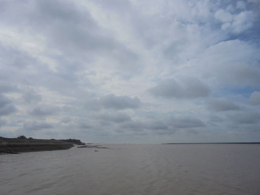
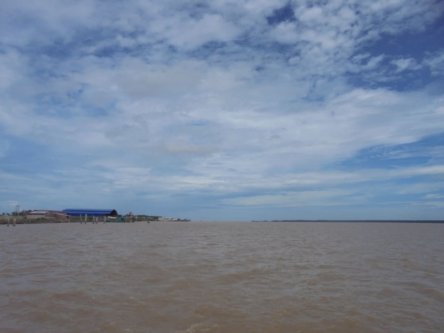
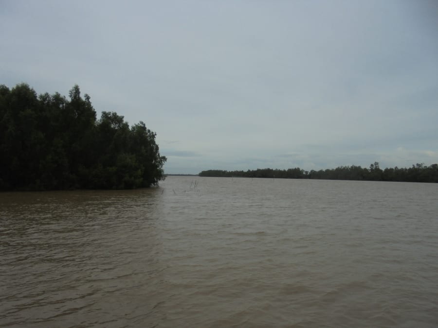
The first mouth sits closest to Saigon, tucked into the northeastern edge of the delta near Tân Phú Đông island. "Tiểu" means small - but standing at the riverbank, there's nothing small about what you see. The water stretches so wide that the far shore is barely visible, a thin dark line between brown water and grey sky.
This is where the Mekong first touches salt. You can't see it happen, but somewhere out there beyond the sandbars, river water and seawater are meeting for the first time. Fishing boats drift past with the current, heading out for the day. Nobody here seems to think much about the fact that they're living at the edge of one of Asia's great rivers. For them, it's just the water.
Cửa Đại (Dai Mouth) - The Great Gate
(Tiền Giang / Bến Tre border)
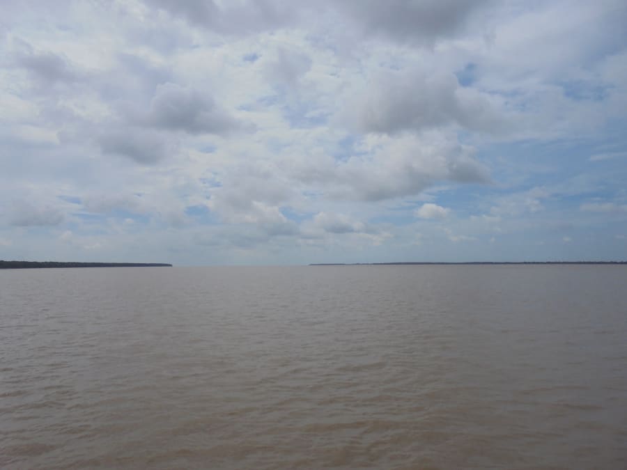
A short ride south, Cửa Đại lives up to its name. The mouth opens wider here, and on the right day you can actually see the line where the muddy brown river water fans out into the darker coastal sea - a visible boundary between two worlds.
More fishing boats here. More activity. Cửa Đại is a working river mouth, not a scenic overlook, and it feels like it. The banks smell of fish and diesel and salt.
Cửa Ba Lai (Ba Lai Mouth) - The Closed Dragon
(Bến Tre province)
Ba Lai is the first mouth that tells you something has changed.
When I arrived, the crossing here was different from the others - a bridge had already been built, so there was no ferry to wait for. At the time I thought little of it. Just infrastructure. Progress.
What I didn't fully understand then was that Ba Lai's story was more complicated. A sluice gate system - the Ba Lai irrigation project - had been constructed across the river mouth to prevent saltwater intrusion into Bến Tre's farmland. The gate controls the flow. The river still exists, but it no longer freely meets the sea.
Ba Lai is the first dragon that was tamed.
When I visited in 2014, it still looked like a functioning river mouth - the water moved, the channel was visible, the crossing felt real. A decade later, satellite images tell a different story. Sediment has built up near the coast, and the connection between river and sea has grown weaker each year. The dam slowed the flow. The silt did the rest.
Rivers don't stay the same for long - and in the Mekong Delta, ten years can be enough to change the shape of a dragon.
It raises a question that stayed with me for the rest of the journey: when humans reshape a river mouth, does it stop being a dragon? Or does it just become a different kind?
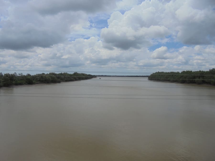
Cửa Hàm Luông (Ham Luong Mouth) - The Dragon's Throat
(Bến Tre province)
Back to the ferries. The crossing at Hàm Luông was one of the longer ones - wide water, a strong current you could feel even on the upper deck of the boat. I loaded my motorbike on with a dozen other bikes, found a spot near the bow, and watched the far bank slowly grow larger.
"Hàm Luông" translates roughly as the dragon's throat - and it feels like one. The river here has real power. You can see it in the way the water moves, the way the ferry engine strains against the current, the way the fishermen handle their boats with practiced efficiency.
Bến Tre province is coconut country, and even near the mouth you can sometimes smell coconut groves carried on the wind behind the mangroves. It's a strange combination - the scale of the river, the sweetness of the air.
Cửa Cổ Chiên (Co Chien Mouth) - The Ancient Flute
(Between Bến Tre and Trà Vinh)
The etymology of "Cổ Chiên" is debated - it may refer to an old musical instrument, or to an ancient battle, depending on who you ask. The name has a poetic, slightly melancholy quality that fits the landscape here.
By Cổ Chiên, the rhythm of the journey had settled into something meditative. Ferry. Bank. Photograph. Ride. Another ferry. The mouths began to feel less like checkboxes and more like chapters - each one a slightly different version of the same story. Wide water. Sky. The brown river meeting something larger than itself.
Cửa Cung Hầu (Cung Hau Mouth) - The Palace Tributary
(Trà Vinh province)

The cultural atmosphere shifts noticeably as you move into Trà Vinh province. There's a large Khmer population here - you start seeing more temple spires, more saffron-robed monks on the road, a different rhythm to the villages. The food changes too.
Cửa Cung Hầu sits at the southern end of the Sông Tiền system, the last mouth before the river transitions to the Hậu branch. It's less dramatic than some of the others - smaller, quieter, without the activity of Cửa Đại or the power of Hàm Luông. But there's something about reaching it that feels like turning a page.
Six mouths down. Three to go.
Cửa Định An (Dinh An Mouth) - The Settled Peace
(Trà Vinh / Sóc Trăng border)
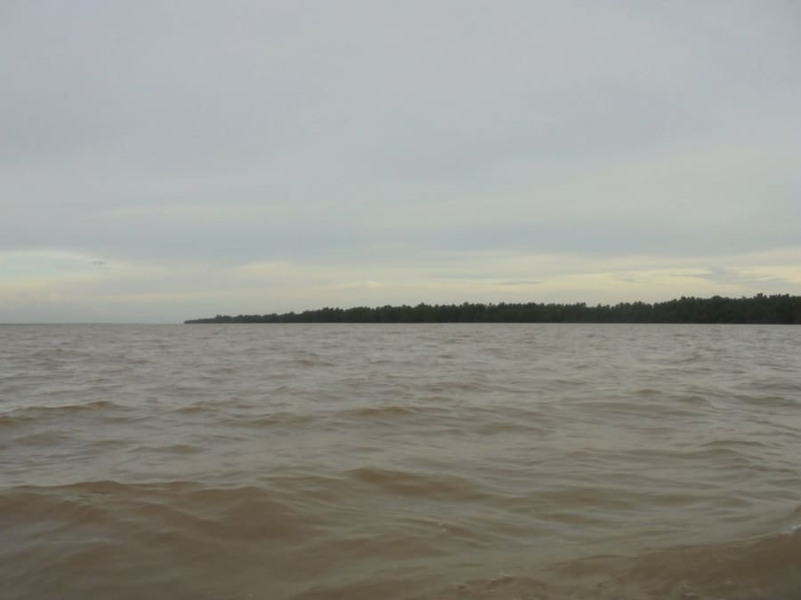
Cửa Định An is where the Sông Hậu - the Mekong's great southern branch - makes its main approach to the sea. This is a working mouth in a serious sense: large cargo vessels use the Định An channel to access the ports of Cần Thơ and the surrounding provinces. You can sometimes see oceangoing ships far out on the water, improbably large against the flat delta horizon.
The landscape here is lower, flatter, more exposed to the tides than the northern mouths. The mangrove fringes feel thinner. The sense of being at the very edge of the land - where solid ground gives way to something less certain - is stronger here than anywhere else on the route.
Cửa Ba Thắc (Ba Thac / Bassac Mouth) - The Ghost Dragon
(Sóc Trăng province)
This is the one that doesn't exist anymore.
Ba Thắc - also called Bassac - silted up sometime in the 1960s. The channel gradually filled with sediment until it was no longer navigable, no longer recognizable as a river mouth. What remains today is a small creek called Sông Cồn Tròn, barely reaching the sea, its opening hidden somewhere behind Cửa Trần Đề.
Officially, Ba Thắc is gone. It doesn't appear on most modern maps as an active river mouth. The ninth dragon died quietly, without announcement, buried under decades of accumulated silt.
I went anyway.
There's something quietly haunting about a river mouth that has ceased to exist. The water still moves - slowly, without purpose. The mangroves have closed in. The fishermen here are fewer. You can feel the absence of something that used to be powerful, the way you can feel a missing tooth with your tongue.
Standing there, I thought about what it means for a river to end. Not dramatically, not in a rush to the sea, but gradually - filling itself in, losing itself, becoming something smaller than it was.
Eight dragons. One ghost.
Cửa Trần Đề (Tran De Mouth) - The Last Dragon
(Sóc Trăng province)
By the time I reached Trần Đề, the light was getting low.
The southernmost mouth of the Mekong is also one of the most active - a busy fishing port, ferries to Côn Đảo island, the traffic of a river that still has things to do before it's done. The water here is wide and the horizon is open in a way that the earlier mouths, flanked by mangroves and sandbars, were not.
I sat at the bank for a while. Behind me: Saigon, eight river crossings, hundreds of kilometers of flat delta road, coconut groves and rice paddies and fish sauce factories and ferry queues and one ghost river and one cow who didn't care about any of it.
Ahead of me: the South China Sea.
Nine dragons. Found - or as many as still exist to be found.
Are There Still Nine River Mouths Today?
The short answer is: no - and the number keeps shrinking.
Ba Thắc silted up naturally - sediment carried down from the Tibetan Plateau over millennia, gradually filling the channel until it closed. This kind of thing has happened to river deltas throughout history. Mouths open and close over geological time.
Ba Lai is a different story. The sluice gate that controls it was built for practical reasons - saltwater intrusion is a serious problem for agriculture in the delta, and the gate protects farmland that millions of people depend on. It's not a villain's decision. It's a difficult tradeoff.
But the result is the same: of the nine mouths that appeared on French colonial maps in the early twentieth century, only seven now function as open, active connections between the Mekong and the sea.
The Nine Dragons are becoming Seven. Slowly, for different reasons, two of them have closed.
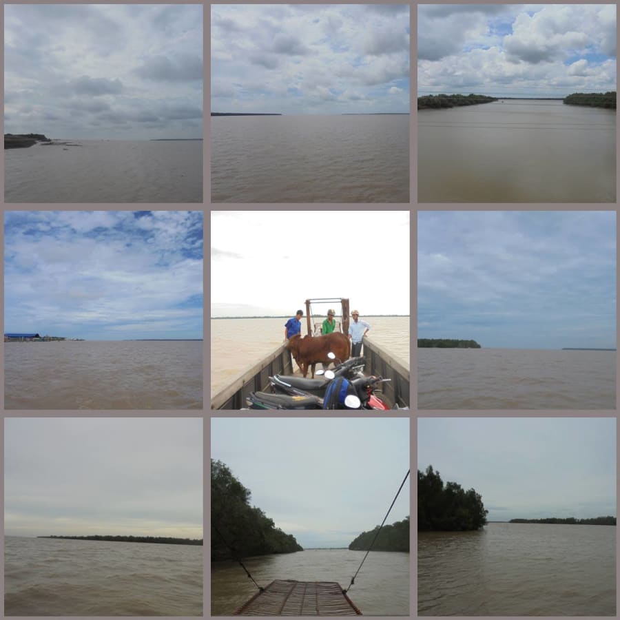
The Nine Dragons - A Visual Summary
Before planning the route yourself, here's a quick visual recap of all nine Mekong river mouths - what they look like from the water, and where they sit on the map.
Travel Tips: Can You Do This Route?
Yes - and it's worth doing. Here's what you need to know.
Route overview: Saigon → Tiền Giang → Bến Tre → Trà Vinh → Sóc Trăng. Roughly 300–350km depending on your exact path to each mouth - manageable in two days at a relaxed pace.
How Long Does It Take?
| Duration | Notes |
|---|---|
| One long day | Possible but exhausting - no time to absorb anything |
| Two days | Recommended - overnight in Bến Tre or Trà Vinh |
| Three days | Ideal - time to explore each province properly |
Best Time to Go
| Season | Conditions |
|---|---|
| Nov – Apr | ✅ Dry season - best road conditions, clear skies |
| May – Jul | ⚠️ Early wet season - manageable but watch for flooding |
| Aug – Oct | ❌ Peak wet season - low-lying coastal roads can flood |
Download Google Maps offline before leaving Saigon. Roads near the river mouths are often small provincial tracks with no signage. Offline maps plus asking locals is the most reliable combination.
Getting there: Take QL50 south from Saigon toward Gò Công in Tiền Giang. From there, follow coastal and provincial roads south, crossing each river as you reach it.
Ferries: Several crossings have been replaced by bridges since this route was first completed. Check current conditions before you go - the situation changes as new infrastructure is built. If ferries are still running on any section, allow extra time; most run only during daylight hours.
ATMs are sparse near the coastal river mouths. Carry enough cash from the last major town - Mỹ Tho, Bến Tre city, or Trà Vinh city - before heading toward each mouth.
Where to Experience the Mekong Delta Rivers
If you want to explore the Mekong Delta waterways beyond this route, these are the best starting points:
- Cần Thơ - the delta's largest city, floating markets and river life at its most vibrant
- Bến Tre - coconut canals, boat trips through narrow waterways, and the quieter side of the delta
- Trà Vinh - Khmer temples, rural landscapes, and some of the least-touristed river scenery in the south
- Sóc Trăng - Khmer and Chinese cultural heritage, and the gateway to the southernmost dragon mouths
Today, the Mekong Delta remains one of Vietnam's most fascinating landscapes to explore by motorbike or boat. The shifting river mouths, fishing villages, and mangrove coastlines make it one of the most unique river systems in Southeast Asia - and one of the least understood by visitors who pass through only the major towns.
Why This Journey
I've traveled a lot of Vietnam. Mountain passes, ancient towns, famous beaches. But riding the length of the Mekong Delta to find every place where the river meets the sea was different from all of it.
It wasn't spectacular in any obvious way. No dramatic cliffs. No famous landmarks. No Instagram moments that translate easily into captions.
What there was: water and sky and time. The particular quality of light on a wide brown river in the late afternoon. The sound of a ferry engine and the smell of the water. The strange peace of being on a boat in the middle of a river with nowhere to be but the other side.
The Mekong has been flowing to this delta for millions of years. It doesn't hurry. It doesn't stop. It just keeps moving, finding its way to the sea through whatever mouths remain open to it.
Nine times - or seven, now - it arrives.
That's worth riding to see.
Have you visited any of the Mekong river mouths? Or done a similar route through the delta? Share your experience in the comments - especially if you have updates on the ferry crossings.