The night before, I barely slept.
Not because of the rain hammering down outside. Not because of the 12km we had ahead of us. It was because of something I'd seen in the dark, on a rocky slope, about 7 hours into the hike.
Something small. Something green. Something that ran on two legs.
But I'm getting ahead of myself.
Getting There
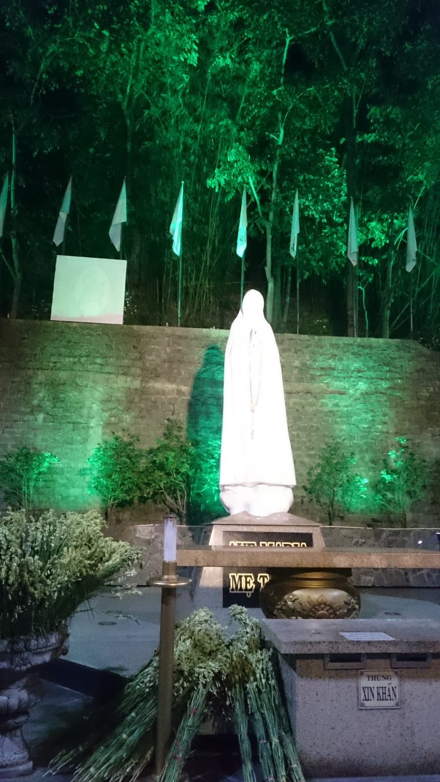
We left Saigon at 8pm, drove through the night, and stopped to rest at Thánh Địa Đức Mẹ Tà Pao - a remote Catholic pilgrimage site carved into the hills of Bình Thuận, quiet and almost otherworldly at that hour.
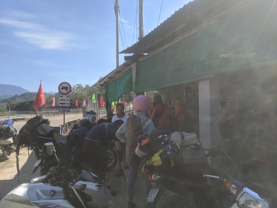
By the time we reached Cầu La Ngà the next morning, the rain had stopped, but the rivers hadn't gotten the memo.
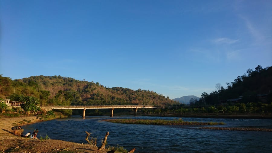
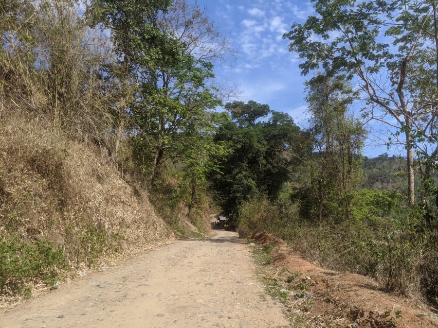
We left our motorbikes at a small stall next to the bridge. The owner pointed us toward a dirt track heading straight into the tree line.
That's where the trail begins.
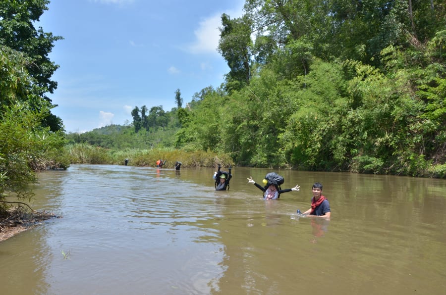
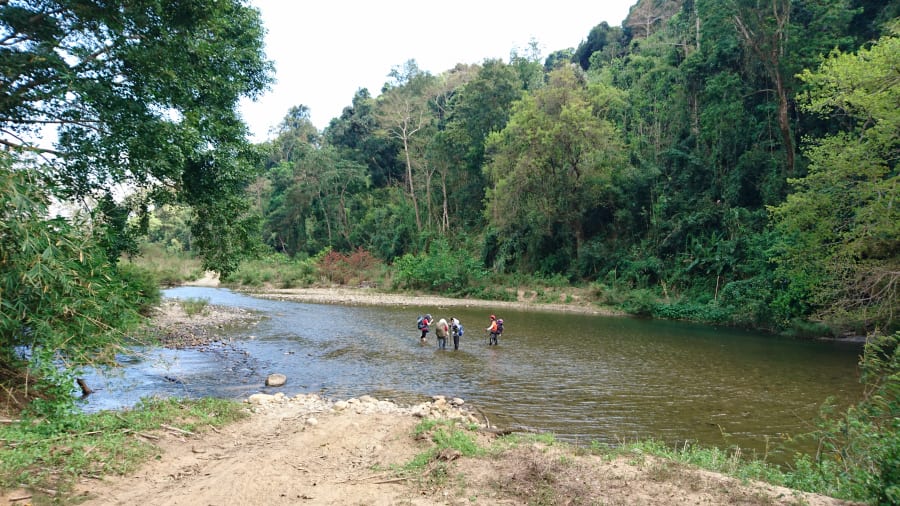
The Trail: One Stream, Ten Crossings
Technically it's one stream - Suối La Ngâu - winding through old-growth forest. But the trail crosses back and forth across its banks ten times before you reach the lake. No trail markings. No facilities. No phone signal.
Just the path that hunters and forest workers have worn into the ground over the years.
Crossing 1 - The First Test
~30 minutes in, past a cashew orchard
The previous night's rain had turned the first crossing into something unrecognizable. Chest-high water, fast current. A group of locals was already sitting on the bank, waiting it out.
We waited 15 minutes. The water didn't drop.
A local guy suggested we head upstream about 100 meters - a cluster of shrubs there slowed the current just enough to make a crossing possible. We eyed it carefully. It still looked sketchy.
Then we noticed he was waiting for us to go first before attempting it himself.
"So he wasn't sure either. He was using us to test it."
We grabbed the shrubs, went one by one, and made it across. He followed.
Crossing 2 - Chest Deep
The widest crossing of the route - an open stretch of river, waist-to-chest deep, but with a manageable current. We lifted our packs above our heads and waded through.
On the far bank: a small wooden house, almost certainly the last sign of human settlement before the deep forest. An old man stood in the doorway watching us without a word.
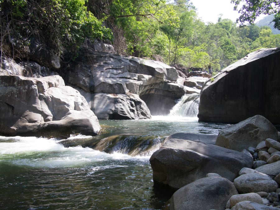
Crossing 3 - The Most Beautiful One
Lunch stop
Canopy so thick the light barely reached the water. Calm flow. Stones visible through the surface. This was the crossing I'd go back for just to sit beside.
We stopped here for lunch.
Crossing 4 - The Real Boss
Then the forest gave us crossing number four.
Width: maybe 6–7 meters. Depth: chest-high. Current: genuinely dangerous. Two of the stronger people in the group tried to wade across and had to turn back. The water pushed sideways with enough force that one slip meant getting swept downstream.
It was 3pm. The water wasn't dropping.
That's when someone found a long bamboo pole.
We cut it, lined up, every person gripping it with both hands - the people on the ends anchoring while those in the middle crossed. It sounds improvised because it was. It worked because it had to.
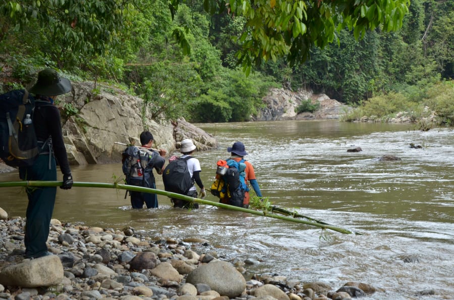
The bamboo pole trick genuinely works. If you're crossing swollen streams in a group, a long pole held horizontally by everyone gives you collective stability against lateral current. We carried ours all the way to camp.
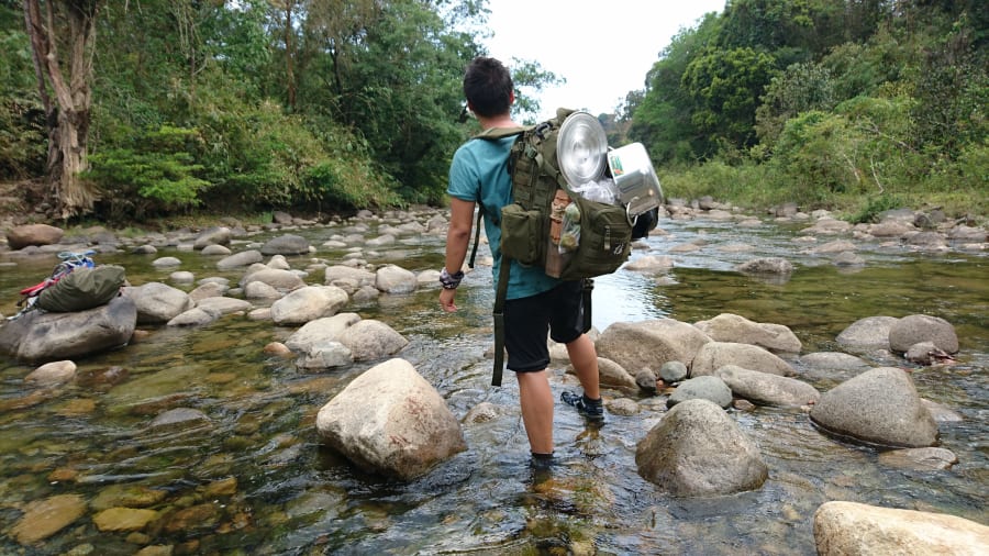
Crossings 5 Through 10
Crossing 5 had a small sandbar beside it. We called it "the mini beach" and promised ourselves we'd come back someday just to sit there.
Crossing 6 was shallow and easy, the light turning golden in late afternoon. We stopped to take photos.
Crossings 7 through 10 came in darkness - wider rivers, deeper water, but with the bamboo pole and legs that had stopped second-guessing, we moved through them without stopping.
7pm - Something in the Dark
We still hadn't reached camp.
The trail dropped toward a rocky slope above the river - no path, just roots and branches and headlamps cutting into blackness. We pushed branches aside to move forward.
Then I heard a rustle to my left.
Something crossed the slope in front of me - small, slightly larger than a big monitor lizard, green. Fast. That part wasn't strange.
What was strange: it ran on two legs.
Not the scrambling four-limbed sprint of a lizard. Something more upright. Three, maybe four seconds. Then gone into the dark.
I asked the others. Nobody else had seen it.
I've never figured out what it was.
8pm - Camp
We reached the riverbank just as full dark settled in.
The sound of water was everywhere - loud and close in the blackness. I lay in my tent thinking about crossing four, about the thing on the slope, about whether this had been a good idea.
I didn't sleep well.
Morning - Why This Trail Exists
Then the sun came up.
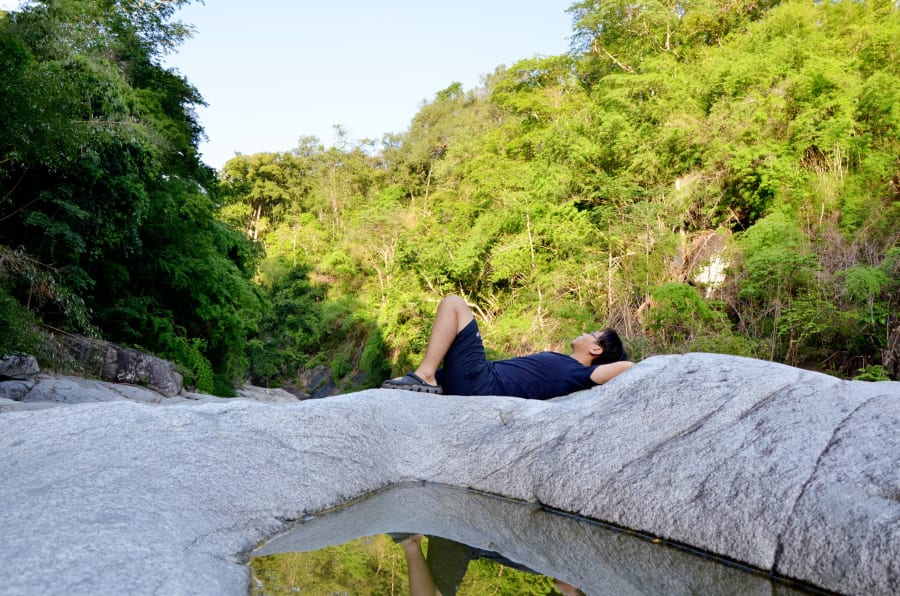
The river that had been roaring the night before was now flowing quietly over stones you could count individually through the surface. Light came through the canopy in long slanted lines and hit the water in ways I don't have the right words for.
This is why the Vietnamese call it Hồ Tiên - Fairy Lake.
We sat there for a long time without needing to say anything.
The Walk Out
The walk back took just as long as the walk in.
Not because we were tired. Not because it was hard.
The crossings that had been red and violent the day before were now clear and ankle-deep. The same river we'd fought so hard to cross had completely transformed overnight. We kept stopping to look at the water - now gentle enough to step through without breaking stride.
Practical Notes
Suối La Ngâu responds quickly to upstream rainfall. Water levels can rise suddenly even on clear days at the trailhead. Do not attempt this route alone. Fatalities have occurred at this location during the wet season - do not underestimate the current.
Best time to go: November to April (dry season). Crossings are manageable and the water is clear. May to October brings fast, unpredictable water levels - the wet season route in this story is not recommended for most hikers.
Two route options today:
- Stream route (this story): Follow the river bank, cross ten times. More scenic, more challenging, best done in a group during dry season.
- Dry route (available since ~2018): A separate trail goes directly to the lake without major stream crossings. Easier, faster, less memorable.
Route Map
- 🔵 Blue route (2016): Stream crossing route - follows the river bank, crosses 10 times. More scenic, more adventurous, wet season not recommended.
- 🟠 Orange route (2018): Dry route - goes straight to the lake without major stream crossings. Easier, reliable year-round, suitable for solo hikers.
What to bring: Trekking poles, dry bags for electronics, sandals you can get wet in, a full change of clothes, headlamp with spare batteries. Group of at least 4 strongly recommended.
Distance: ~12km one way. Plan for a full day in, overnight camp at the lake, full day out.
Have you done the stream crossing route into Hồ Tiên? I'd genuinely like to know if anyone else has seen what I saw on that slope.